You are here: Home > Network List > TJ - Tajikistan National Seismic Network Stations List
> Station GARM Garm, Tajikistan > Earthquake Result Viewer
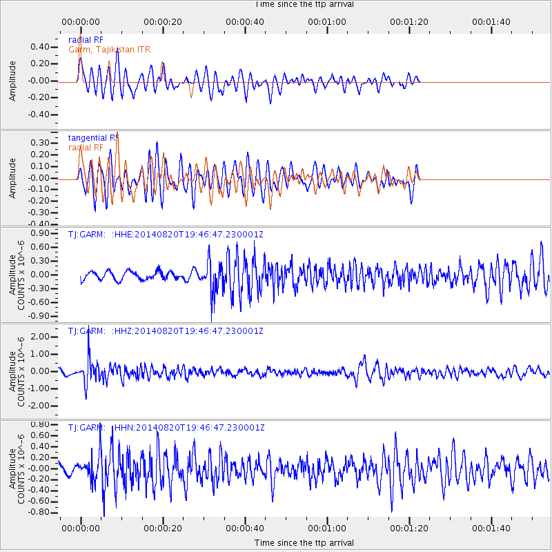
GARM Garm, Tajikistan - Earthquake Result Viewer
*The percent match for this event was below the threshold and hence no stack was calculated.
| Earthquake location: |
Southeast Of Honshu, Japan |
| Earthquake latitude/longitude: |
33.2/138.1 |
| Earthquake time(UTC): |
2014/08/20 (232) 19:38:25 GMT |
| Earthquake Depth: |
308 km |
| Earthquake Magnitude: |
5.4 MW, 5.2 mb |
| Earthquake Catalog/Contributor: |
ISC/ISC |
|
| Network: |
TJ Tajikistan National Seismic Network |
| Station: |
GARM Garm, Tajikistan |
| Lat/Lon: |
39.00 N/70.32 E |
| Elevation: |
1305 m |
|
| Distance: |
54.0 deg |
| Az: |
296.841 deg |
| Baz: |
73.765 deg |
| Ray Param: |
$rayparam |
*The percent match for this event was below the threshold and hence was not used in the summary stack. |
|
| Radial Match: |
71.5951 % |
| Radial Bump: |
400 |
| Transverse Match: |
66.30329 % |
| Transverse Bump: |
400 |
| SOD ConfigId: |
3390531 |
| Insert Time: |
2019-04-13 12:05:39.702 +0000 |
| GWidth: |
2.5 |
| Max Bumps: |
400 |
| Tol: |
0.001 |
|
Signal To Noise
| Channel | StoN | STA | LTA |
| TJ:GARM: :HHZ:20140820T19:46:47.230001Z | 5.915219 | 7.155717E-7 | 1.209713E-7 |
| TJ:GARM: :HHN:20140820T19:46:47.230001Z | 2.6251428 | 2.2314138E-7 | 8.5001616E-8 |
| TJ:GARM: :HHE:20140820T19:46:47.230001Z | 3.761731 | 3.2698006E-7 | 8.692277E-8 |
| Arrivals |
| Ps | |
| PpPs | |
| PsPs/PpSs | |


