You are here: Home > Network List > UW - Pacific Northwest Regional Seismic Network Stations List
> Station LEBA Lebam, WA, USA > Earthquake Result Viewer
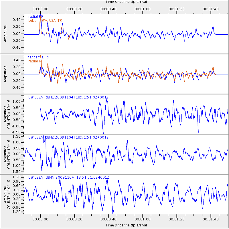
LEBA Lebam, WA, USA - Earthquake Result Viewer
*The percent match for this event was below the threshold and hence no stack was calculated.
| Earthquake location: |
Azores Islands Region |
| Earthquake latitude/longitude: |
36.2/-33.9 |
| Earthquake time(UTC): |
2009/11/04 (308) 18:41:44 GMT |
| Earthquake Depth: |
10 km |
| Earthquake Magnitude: |
5.7 MB, 5.6 MS, 5.9 MW, 5.8 MW |
| Earthquake Catalog/Contributor: |
WHDF/NEIC |
|
| Network: |
UW Pacific Northwest Regional Seismic Network |
| Station: |
LEBA Lebam, WA, USA |
| Lat/Lon: |
46.55 N/123.56 W |
| Elevation: |
73 m |
|
| Distance: |
64.7 deg |
| Az: |
310.208 deg |
| Baz: |
63.572 deg |
| Ray Param: |
$rayparam |
*The percent match for this event was below the threshold and hence was not used in the summary stack. |
|
| Radial Match: |
74.0929 % |
| Radial Bump: |
400 |
| Transverse Match: |
47.4799 % |
| Transverse Bump: |
400 |
| SOD ConfigId: |
2622 |
| Insert Time: |
2010-02-27 04:41:51.593 +0000 |
| GWidth: |
2.5 |
| Max Bumps: |
400 |
| Tol: |
0.001 |
|
Signal To Noise
| Channel | StoN | STA | LTA |
| UW:LEBA: :BHZ:20091104T18:51:51.024001Z | 3.294222 | 9.29537E-7 | 2.8217195E-7 |
| UW:LEBA: :BHN:20091104T18:51:51.024001Z | 0.6670497 | 2.0448955E-7 | 3.0655818E-7 |
| UW:LEBA: :BHE:20091104T18:51:51.024001Z | 1.9335662 | 4.7715395E-7 | 2.4677405E-7 |
| Arrivals |
| Ps | |
| PpPs | |
| PsPs/PpSs | |


