You are here: Home > Network List > US - United States National Seismic Network Stations List
> Station HAWA Hanford, Washington, USA > Earthquake Result Viewer
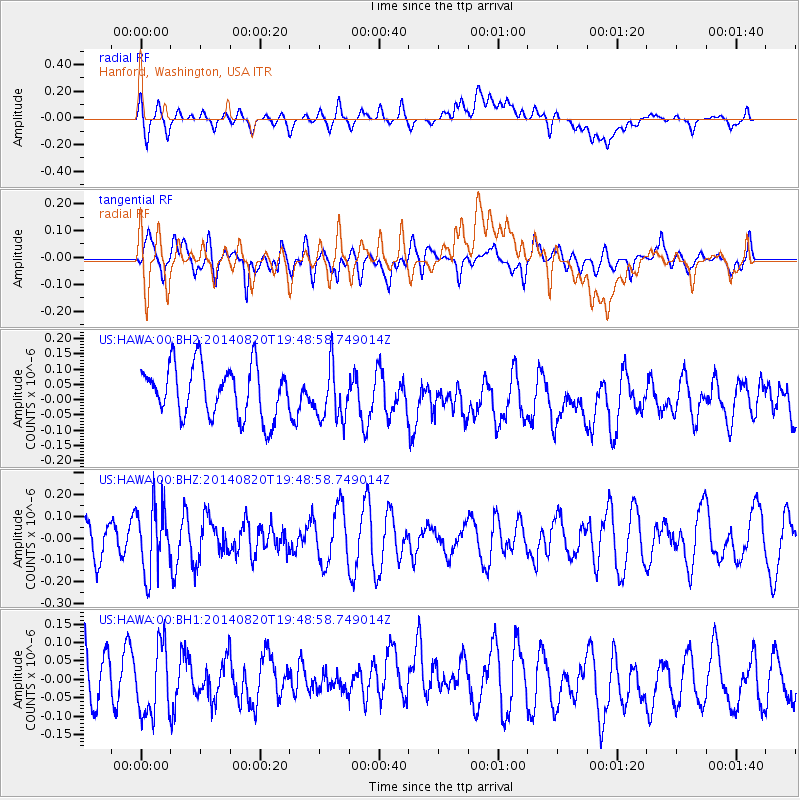
HAWA Hanford, Washington, USA - Earthquake Result Viewer
*The percent match for this event was below the threshold and hence no stack was calculated.
| Earthquake location: |
Southeast Of Honshu, Japan |
| Earthquake latitude/longitude: |
33.2/138.1 |
| Earthquake time(UTC): |
2014/08/20 (232) 19:38:25 GMT |
| Earthquake Depth: |
308 km |
| Earthquake Magnitude: |
5.4 MW, 5.2 mb |
| Earthquake Catalog/Contributor: |
ISC/ISC |
|
| Network: |
US United States National Seismic Network |
| Station: |
HAWA Hanford, Washington, USA |
| Lat/Lon: |
46.39 N/119.53 W |
| Elevation: |
364 m |
|
| Distance: |
74.4 deg |
| Az: |
44.59 deg |
| Baz: |
301.74 deg |
| Ray Param: |
$rayparam |
*The percent match for this event was below the threshold and hence was not used in the summary stack. |
|
| Radial Match: |
54.851547 % |
| Radial Bump: |
400 |
| Transverse Match: |
52.19507 % |
| Transverse Bump: |
400 |
| SOD ConfigId: |
3390531 |
| Insert Time: |
2019-04-13 12:06:04.242 +0000 |
| GWidth: |
2.5 |
| Max Bumps: |
400 |
| Tol: |
0.001 |
|
Signal To Noise
| Channel | StoN | STA | LTA |
| US:HAWA:00:BHZ:20140820T19:48:58.749014Z | 1.5348758 | 1.5654102E-7 | 1.0198938E-7 |
| US:HAWA:00:BH1:20140820T19:48:58.749014Z | 1.3936994 | 9.354057E-8 | 6.711675E-8 |
| US:HAWA:00:BH2:20140820T19:48:58.749014Z | 1.0619377 | 8.887048E-8 | 8.3687084E-8 |
| Arrivals |
| Ps | |
| PpPs | |
| PsPs/PpSs | |


