You are here: Home > Network List > UW - Pacific Northwest Regional Seismic Network Stations List
> Station LEBA Lebam, WA, USA > Earthquake Result Viewer
LEBA Lebam, WA, USA - Earthquake Result Viewer
*The percent match for this event was below the threshold and hence no stack was calculated.
| Earthquake location: |
Andreanof Islands, Aleutian Is. |
| Earthquake latitude/longitude: |
51.3/-178.2 |
| Earthquake time(UTC): |
2009/06/22 (173) 19:55:24 GMT |
| Earthquake Depth: |
35 km |
| Earthquake Magnitude: |
5.6 MB, 5.6 MW, 5.6 MW |
| Earthquake Catalog/Contributor: |
WHDF/NEIC |
|
| Network: |
UW Pacific Northwest Regional Seismic Network |
| Station: |
LEBA Lebam, WA, USA |
| Lat/Lon: |
46.55 N/123.56 W |
| Elevation: |
73 m |
|
| Distance: |
35.5 deg |
| Az: |
75.679 deg |
| Baz: |
298.145 deg |
| Ray Param: |
$rayparam |
*The percent match for this event was below the threshold and hence was not used in the summary stack. |
|
| Radial Match: |
64.4963 % |
| Radial Bump: |
400 |
| Transverse Match: |
64.80975 % |
| Transverse Bump: |
400 |
| SOD ConfigId: |
2648 |
| Insert Time: |
2010-02-27 04:41:54.347 +0000 |
| GWidth: |
2.5 |
| Max Bumps: |
400 |
| Tol: |
0.001 |
|
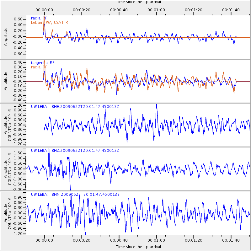
Signal To Noise
| Channel | StoN | STA | LTA |
| UW:LEBA: :BHZ:20090622T20:01:47.450013Z | 3.1304846 | 6.5028576E-7 | 2.0772687E-7 |
| UW:LEBA: :BHN:20090622T20:01:47.450013Z | 1.3540015 | 3.4160823E-7 | 2.522953E-7 |
| UW:LEBA: :BHE:20090622T20:01:47.450013Z | 1.9694579 | 4.30798E-7 | 2.1873939E-7 |
| Arrivals |
| Ps | |
| PpPs | |
| PsPs/PpSs | |


