You are here: Home > Network List > TA - USArray Transportable Network (new EarthScope stations) Stations List
> Station 249A Camden, AL, USA > Earthquake Result Viewer
249A Camden, AL, USA - Earthquake Result Viewer

| Earthquake location: |
Northern Mid-Atlantic Ridge |
| Earthquake latitude/longitude: |
10.7/-42.6 |
| Earthquake time(UTC): |
2013/06/24 (175) 22:04:13 GMT |
| Earthquake Depth: |
10 km |
| Earthquake Magnitude: |
6.5 MW, 6.1 MB, 6.3 MS, 6.6 MW |
| Earthquake Catalog/Contributor: |
NEIC PDE/NEIC PDE-W |
|
| Network: |
TA USArray Transportable Network (new EarthScope stations) |
| Station: |
249A Camden, AL, USA |
| Lat/Lon: |
31.98 N/87.12 W |
| Elevation: |
66 m |
|
| Distance: |
46.2 deg |
| Az: |
304.275 deg |
| Baz: |
107.132 deg |
| Ray Param: |
0.070818886 |
| Estimated Moho Depth: |
12.0 km |
| Estimated Crust Vp/Vs: |
2.03 |
| Assumed Crust Vp: |
6.187 km/s |
| Estimated Crust Vs: |
3.044 km/s |
| Estimated Crust Poisson's Ratio: |
0.34 |
|
| Radial Match: |
94.63072 % |
| Radial Bump: |
400 |
| Transverse Match: |
88.585556 % |
| Transverse Bump: |
400 |
| SOD ConfigId: |
512894 |
| Insert Time: |
2013-09-15 09:35:31.314 +0000 |
| GWidth: |
2.5 |
| Max Bumps: |
400 |
| Tol: |
0.001 |
|
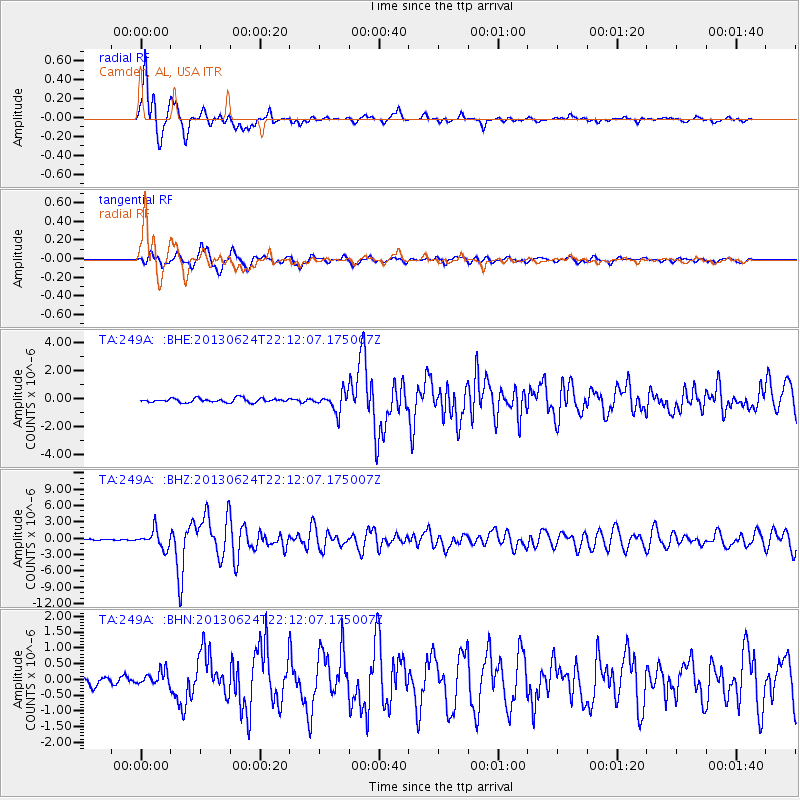
Signal To Noise
| Channel | StoN | STA | LTA |
| TA:249A: :BHZ:20130624T22:12:07.175007Z | 14.897944 | 1.6151986E-6 | 1.08417545E-7 |
| TA:249A: :BHN:20130624T22:12:07.175007Z | 1.6379803 | 2.3235717E-7 | 1.4185589E-7 |
| TA:249A: :BHE:20130624T22:12:07.175007Z | 4.6790524 | 6.742483E-7 | 1.4409933E-7 |
| Arrivals |
| Ps | 2.1 SECOND |
| PpPs | 5.6 SECOND |
| PsPs/PpSs | 7.7 SECOND |


