You are here: Home > Network List > UW - Pacific Northwest Regional Seismic Network Stations List
> Station MRBL Marblemount, WA, USA > Earthquake Result Viewer
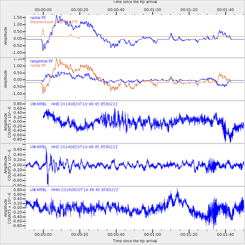
MRBL Marblemount, WA, USA - Earthquake Result Viewer
*The percent match for this event was below the threshold and hence no stack was calculated.
| Earthquake location: |
Southeast Of Honshu, Japan |
| Earthquake latitude/longitude: |
33.2/138.1 |
| Earthquake time(UTC): |
2014/08/20 (232) 19:38:25 GMT |
| Earthquake Depth: |
308 km |
| Earthquake Magnitude: |
5.4 MW, 5.2 mb |
| Earthquake Catalog/Contributor: |
ISC/ISC |
|
| Network: |
UW Pacific Northwest Regional Seismic Network |
| Station: |
MRBL Marblemount, WA, USA |
| Lat/Lon: |
48.52 N/121.48 W |
| Elevation: |
75 m |
|
| Distance: |
72.2 deg |
| Az: |
43.393 deg |
| Baz: |
299.961 deg |
| Ray Param: |
$rayparam |
*The percent match for this event was below the threshold and hence was not used in the summary stack. |
|
| Radial Match: |
46.879276 % |
| Radial Bump: |
400 |
| Transverse Match: |
64.99448 % |
| Transverse Bump: |
400 |
| SOD ConfigId: |
3390531 |
| Insert Time: |
2019-04-13 12:06:42.674 +0000 |
| GWidth: |
2.5 |
| Max Bumps: |
400 |
| Tol: |
0.001 |
|
Signal To Noise
| Channel | StoN | STA | LTA |
| UW:MRBL: :HHZ:20140820T19:48:45.858022Z | 3.497759 | 2.7863572E-7 | 7.9661206E-8 |
| UW:MRBL: :HHN:20140820T19:48:45.858022Z | 0.9018299 | 1.5013596E-7 | 1.6647924E-7 |
| UW:MRBL: :HHE:20140820T19:48:45.858022Z | 0.69469714 | 1.6667151E-7 | 2.3991967E-7 |
| Arrivals |
| Ps | |
| PpPs | |
| PsPs/PpSs | |


