LON Longmire (broad-band and DWWSSN) - Earthquake Result Viewer
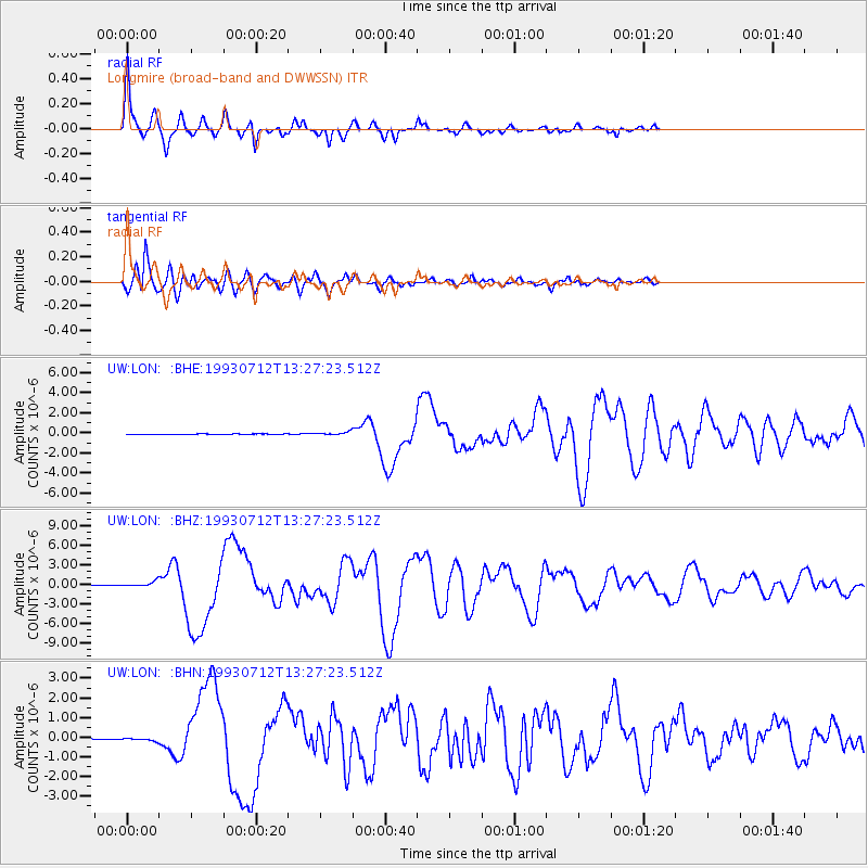
Earthquake location: Hokkaido, Japan Region
Earthquake latitude/longitude: 42.8/139.2
Earthquake time(UTC): 1993/07/12 (193) 13:17:11 GMT
Earthquake Depth: 17 km
Earthquake Magnitude: 6.7 MB, 7.6 MS, 7.3 UNKNOWN, 7.8 MW
Earthquake Catalog/Contributor: WHDF/NEIC
Network: UW Pacific Northwest Regional Seismic Network
Station: LON Longmire (broad-band and DWWSSN)
Lat/Lon: 46.75 N/121.81 W
Elevation: 850 m
Distance: 65.6 deg
Az: 48.241 deg
Baz: 307.068 deg
Ray Param: 0.058158904
Estimated Moho Depth: 39.25 km
Estimated Crust Vp/Vs: 1.73
Assumed Crust Vp: 6.597 km/s
Estimated Crust Vs: 3.819 km/s
Estimated Crust Poisson's Ratio: 0.25
Radial Match: 96.90486 %
Radial Bump: 362
Transverse Match: 92.43762 %
Transverse Bump: 400
SOD ConfigId: 4480
Insert Time: 2010-02-27 04:42:30.234 +0000
GWidth: 2.5
Max Bumps: 400
Tol: 0.001

Signal To Noise

ChannelStoNSTALTA
UW:LON: :BHZ:19930712T13:27:23.512Z15.3270083.7907904E-72.473275E-8
UW:LON: :BHN:19930712T13:27:23.512Z4.8735527.039599E-81.44444945E-8
UW:LON: :BHE:19930712T13:27:23.512Z8.1427451.4433994E-71.7726201E-8
Arrivals
Ps4.5 SECOND
PpPs16 SECOND
PsPs/PpSs20 SECOND