
LON Longmire (broad-band and DWWSSN) - Earthquake Result Viewer
| ||||||||||||||||||
| ||||||||||||||||||
| ||||||||||||||||||
|
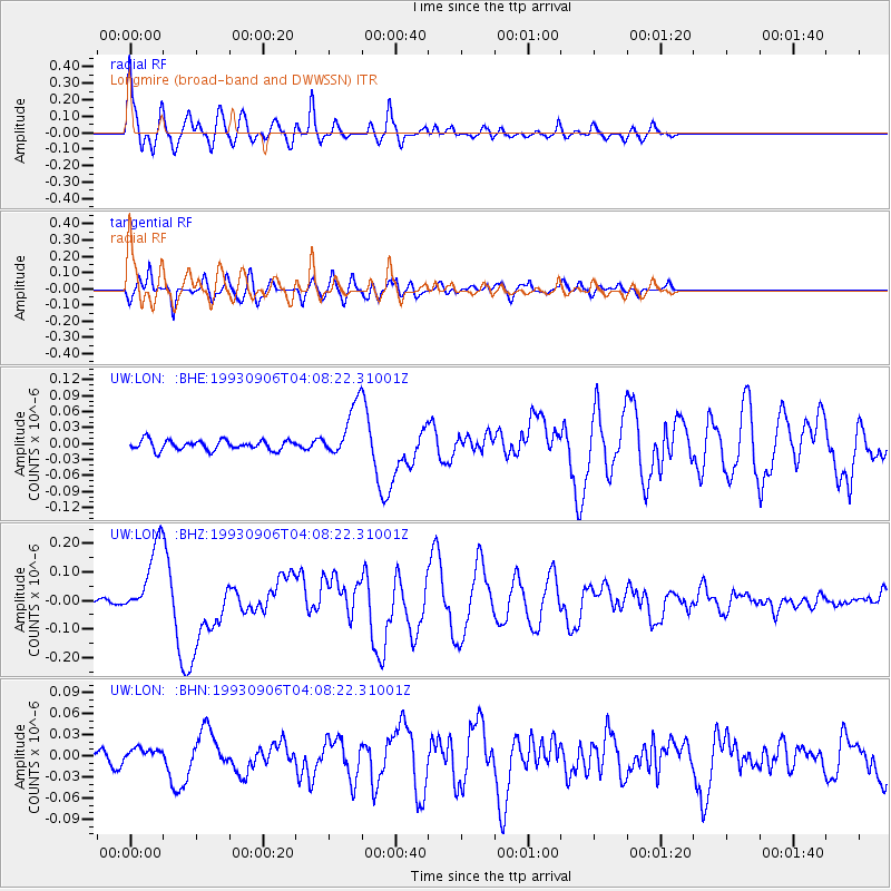
Signal To Noise
| Channel | StoN | STA | LTA |
| UW:LON: :BHZ:19930906T04:08:22.31001Z | 18.044954 | 1.2810074E-7 | 7.0989774E-9 |
| UW:LON: :BHN:19930906T04:08:22.31001Z | 1.9773824 | 1.1148592E-8 | 5.638056E-9 |
| UW:LON: :BHE:19930906T04:08:22.31001Z | 5.33883 | 4.919969E-8 | 9.215445E-9 |
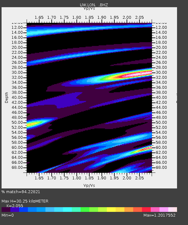
| Arrivals | |
| Ps | 4.9 SECOND |
| PpPs | 14 SECOND |
| PsPs/PpSs | 19 SECOND |

