LON Longmire (broad-band and DWWSSN) - Earthquake Result Viewer
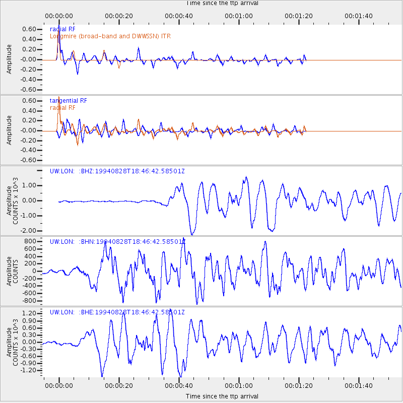
Earthquake location: East Of Kuril Islands
Earthquake latitude/longitude: 44.7/150.2
Earthquake time(UTC): 1994/08/28 (240) 18:37:19 GMT
Earthquake Depth: 14 km
Earthquake Magnitude: 6.0 MB, 6.5 MS, 6.3 UNKNOWN, 6.7 MW
Earthquake Catalog/Contributor: WHDF/NEIC
Network: UW Pacific Northwest Regional Seismic Network
Station: LON Longmire (broad-band and DWWSSN)
Lat/Lon: 46.75 N/121.81 W
Elevation: 850 m
Distance: 58.3 deg
Az: 53.904 deg
Baz: 303.079 deg
Ray Param: 0.062949084
Estimated Moho Depth: 13.75 km
Estimated Crust Vp/Vs: 1.61
Assumed Crust Vp: 6.597 km/s
Estimated Crust Vs: 4.111 km/s
Estimated Crust Poisson's Ratio: 0.18
Radial Match: 92.93215 %
Radial Bump: 361
Transverse Match: 89.17923 %
Transverse Bump: 400
SOD ConfigId: 17000
Insert Time: 2010-02-27 04:43:04.356 +0000
GWidth: 2.5
Max Bumps: 400
Tol: 0.001

Signal To Noise

ChannelStoNSTALTA
UW:LON: :BHN:19940828T18:46:42.58501Z2.09988149.19017823.42522
UW:LON: :BHE:19940828T18:46:42.58501Z0.8880605738.1108342.914673
UW:LON: :BHZ:19940828T18:46:42.58501Z3.86258492.4027323.922518
Arrivals
Ps1.3 SECOND
PpPs5.1 SECOND
PsPs/PpSs6.5 SECOND