You are here: Home > Network List > GS - US Geological Survey Networks Stations List
> Station KAN10 Keim Farm > Earthquake Result Viewer
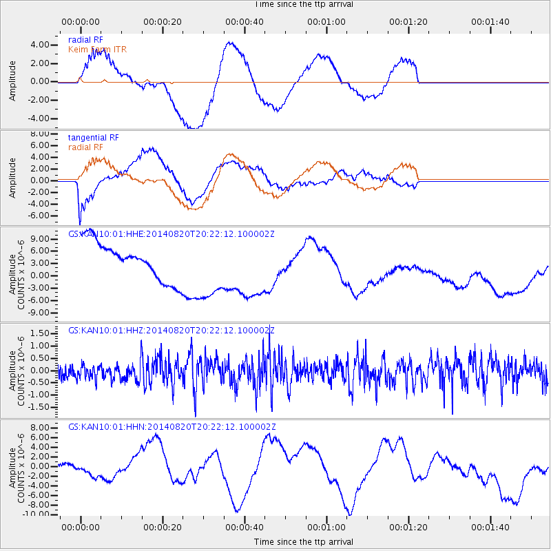
KAN10 Keim Farm - Earthquake Result Viewer
*The percent match for this event was below the threshold and hence no stack was calculated.
| Earthquake location: |
Rat Islands, Aleutian Islands |
| Earthquake latitude/longitude: |
52.5/175.4 |
| Earthquake time(UTC): |
2014/08/20 (232) 20:12:38 GMT |
| Earthquake Depth: |
5.2 km |
| Earthquake Magnitude: |
5.6 MW, 5.4 mb, 5.3 Ms_20, 5.5 Mwb, 5.0 ML, 5.6 Mwc |
| Earthquake Catalog/Contributor: |
ISC/ISC |
|
| Network: |
GS US Geological Survey Networks |
| Station: |
KAN10 Keim Farm |
| Lat/Lon: |
37.12 N/98.10 W |
| Elevation: |
417 m |
|
| Distance: |
59.7 deg |
| Az: |
67.59 deg |
| Baz: |
315.011 deg |
| Ray Param: |
$rayparam |
*The percent match for this event was below the threshold and hence was not used in the summary stack. |
|
| Radial Match: |
80.624214 % |
| Radial Bump: |
400 |
| Transverse Match: |
59.528072 % |
| Transverse Bump: |
400 |
| SOD ConfigId: |
3390531 |
| Insert Time: |
2019-04-13 12:17:05.546 +0000 |
| GWidth: |
2.5 |
| Max Bumps: |
400 |
| Tol: |
0.001 |
|
Signal To Noise
| Channel | StoN | STA | LTA |
| GS:KAN10:01:HHZ:20140820T20:22:12.100002Z | 0.7572754 | 2.7686E-7 | 3.6560013E-7 |
| GS:KAN10:01:HHN:20140820T20:22:12.100002Z | 0.22283061 | 1.0356607E-6 | 4.647749E-6 |
| GS:KAN10:01:HHE:20140820T20:22:12.100002Z | 1.8133388 | 8.243707E-6 | 4.546149E-6 |
| Arrivals |
| Ps | |
| PpPs | |
| PsPs/PpSs | |


