
LON Longmire (broad-band and DWWSSN) - Earthquake Result Viewer
| ||||||||||||||||||
| ||||||||||||||||||
| ||||||||||||||||||
|
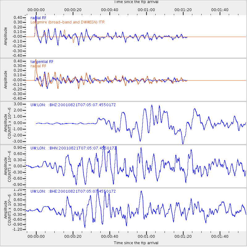
Signal To Noise
| Channel | StoN | STA | LTA |
| UW:LON: :BHN:20010821T07:05:07.455017Z | 1.2742928 | 1.097105E-7 | 8.60952E-8 |
| UW:LON: :BHE:20010821T07:05:07.455017Z | 1.5722739 | 1.0855007E-7 | 6.904018E-8 |
| UW:LON: :BHZ:20010821T07:05:07.455017Z | 6.8421392 | 3.8144856E-7 | 5.57499E-8 |
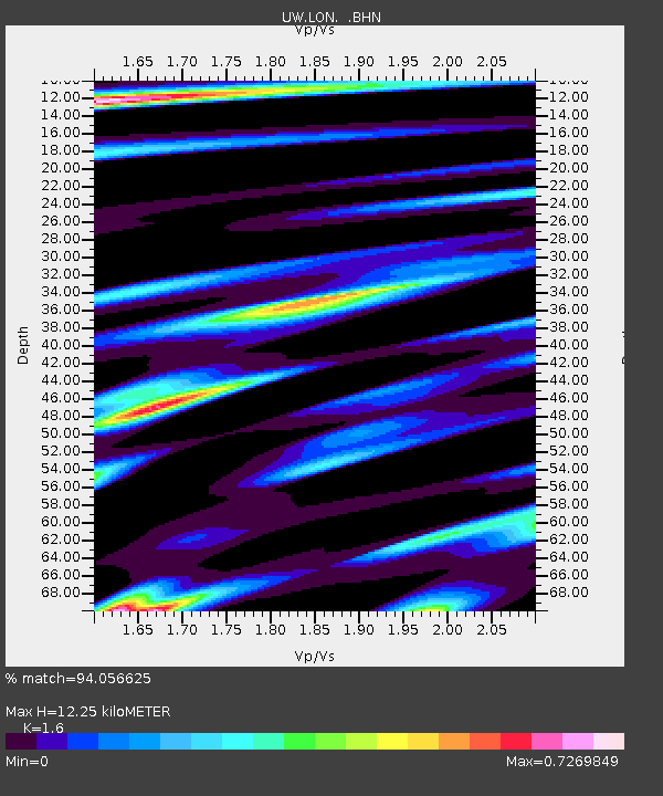
| Arrivals | |
| Ps | 1.1 SECOND |
| PpPs | 4.7 SECOND |
| PsPs/PpSs | 5.9 SECOND |

