
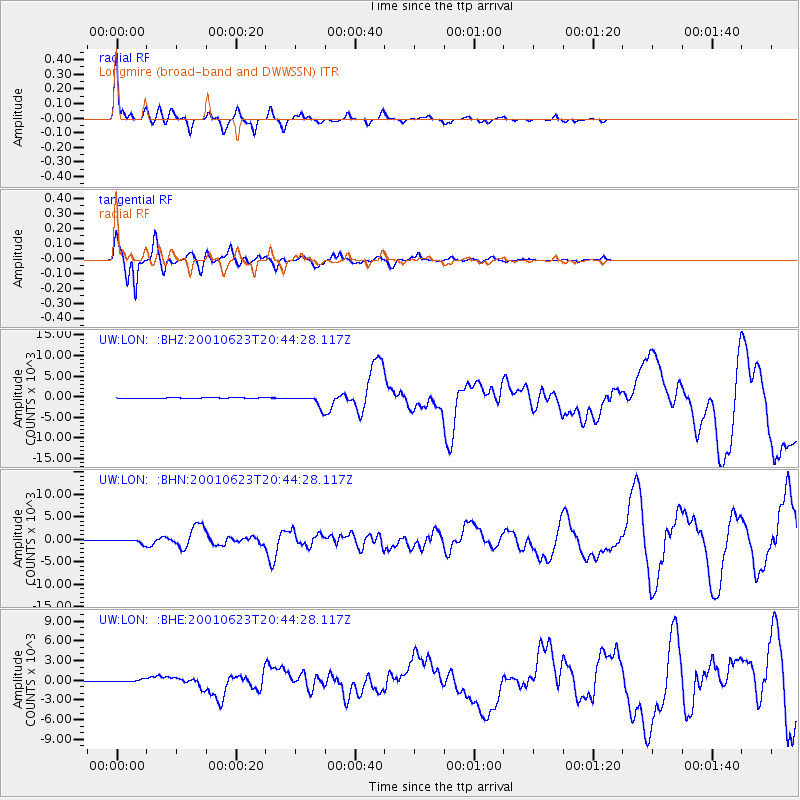
LON Longmire (broad-band and DWWSSN) - Earthquake Result Viewer
| ||||||||||||||||||
| ||||||||||||||||||
| ||||||||||||||||||
|
Signal To Noise
| Channel | StoN | STA | LTA |
| UW:LON: :BHN:20010623T20:44:28.117Z | 10.295998 | 423.47647 | 41.130203 |
| UW:LON: :BHE:20010623T20:44:28.117Z | 2.4268627 | 163.44614 | 67.34873 |
| UW:LON: :BHZ:20010623T20:44:28.117Z | 37.922947 | 1385.6735 | 36.539185 |
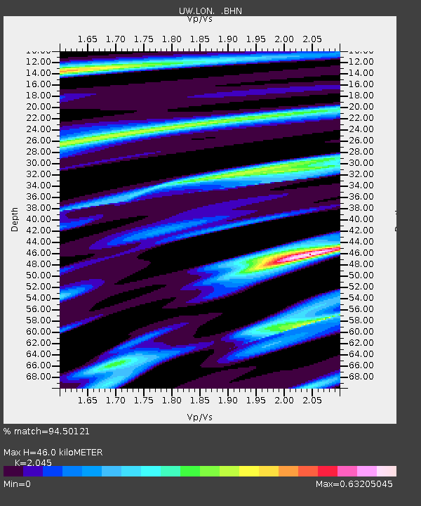
| Arrivals | |
| Ps | 7.5 SECOND |
| PpPs | 21 SECOND |
| PsPs/PpSs | 28 SECOND |

