You are here: Home > Network List > US - United States National Seismic Network Stations List
> Station AMTX Amarillo, Texas, USA > Earthquake Result Viewer
AMTX Amarillo, Texas, USA - Earthquake Result Viewer
*The percent match for this event was below the threshold and hence no stack was calculated.
| Earthquake location: |
Northern Mid-Atlantic Ridge |
| Earthquake latitude/longitude: |
10.7/-42.6 |
| Earthquake time(UTC): |
2013/06/24 (175) 22:04:13 GMT |
| Earthquake Depth: |
10 km |
| Earthquake Magnitude: |
6.5 MW, 6.1 MB, 6.3 MS, 6.6 MW |
| Earthquake Catalog/Contributor: |
NEIC PDE/NEIC PDE-W |
|
| Network: |
US United States National Seismic Network |
| Station: |
AMTX Amarillo, Texas, USA |
| Lat/Lon: |
34.53 N/101.41 W |
| Elevation: |
1010 m |
|
| Distance: |
58.4 deg |
| Az: |
303.961 deg |
| Baz: |
99.112 deg |
| Ray Param: |
$rayparam |
*The percent match for this event was below the threshold and hence was not used in the summary stack. |
|
| Radial Match: |
85.60492 % |
| Radial Bump: |
400 |
| Transverse Match: |
61.472134 % |
| Transverse Bump: |
400 |
| SOD ConfigId: |
512894 |
| Insert Time: |
2013-09-15 09:55:28.725 +0000 |
| GWidth: |
2.5 |
| Max Bumps: |
400 |
| Tol: |
0.001 |
|
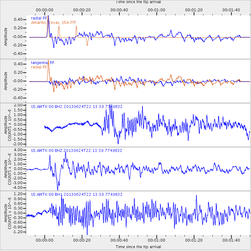
Signal To Noise
| Channel | StoN | STA | LTA |
| US:AMTX:00:BHZ:20130624T22:13:39.774983Z | 7.9027624 | 8.924922E-7 | 1.1293421E-7 |
| US:AMTX:00:BH1:20130624T22:13:39.774983Z | 2.726455 | 2.72385E-7 | 9.990446E-8 |
| US:AMTX:00:BH2:20130624T22:13:39.774983Z | 1.8483431 | 4.6536888E-7 | 2.5177624E-7 |
| Arrivals |
| Ps | |
| PpPs | |
| PsPs/PpSs | |


