
LON Longmire (broad-band and DWWSSN) - Earthquake Result Viewer
| ||||||||||||||||||
| ||||||||||||||||||
| ||||||||||||||||||
|
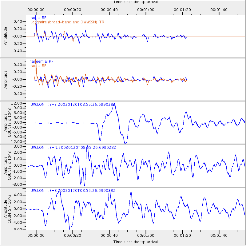
Signal To Noise
| Channel | StoN | STA | LTA |
| UW:LON: :BHN:20030120T08:55:26.699028Z | 3.0565045 | 372.24454 | 121.78766 |
| UW:LON: :BHE:20030120T08:55:26.699028Z | 4.9376597 | 1074.5659 | 217.62656 |
| UW:LON: :BHZ:20030120T08:55:26.699028Z | 18.00189 | 2972.426 | 165.11743 |
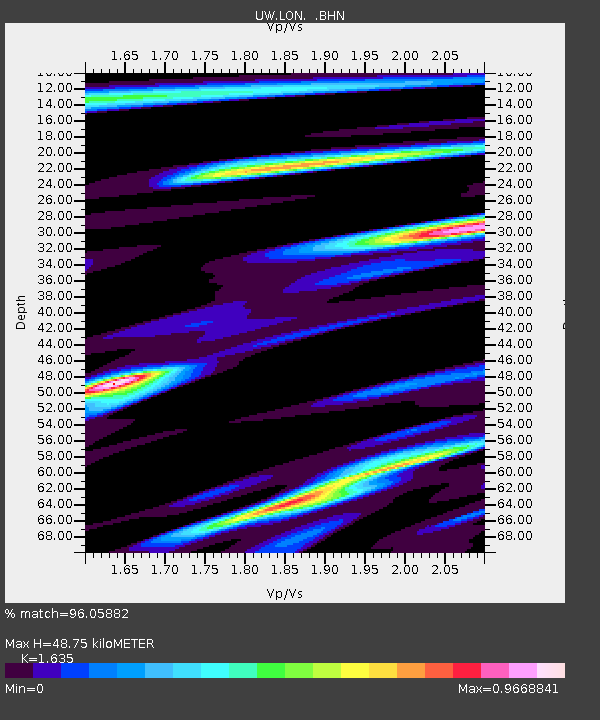
| Arrivals | |
| Ps | 4.8 SECOND |
| PpPs | 19 SECOND |
| PsPs/PpSs | 24 SECOND |

