LON Longmire (broad-band and DWWSSN) - Earthquake Result Viewer
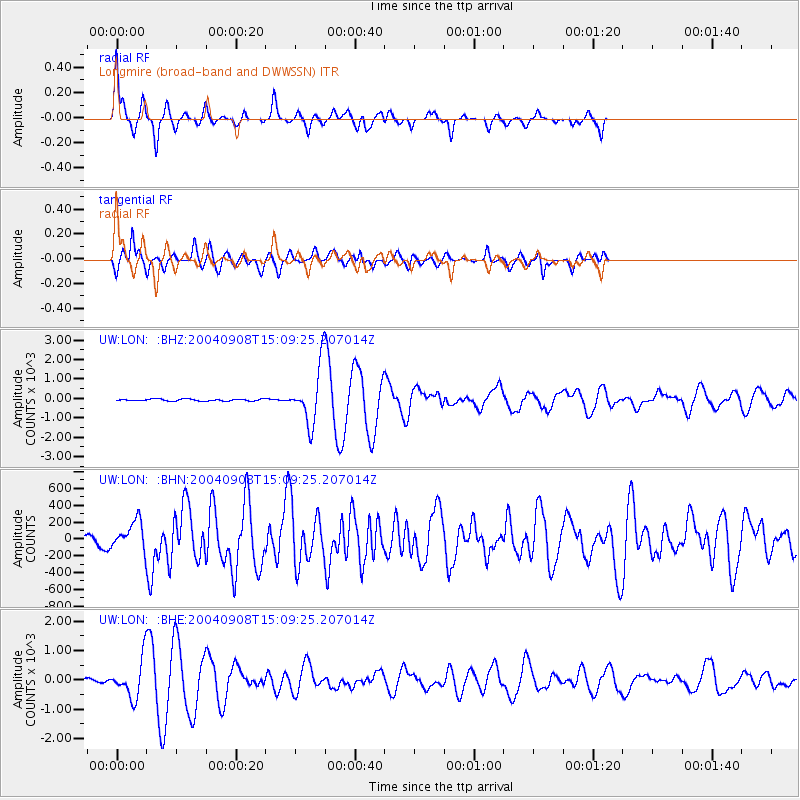
Earthquake location: Near S. Coast Of Honshu, Japan
Earthquake latitude/longitude: 33.1/137.2
Earthquake time(UTC): 2004/09/08 (252) 14:58:25 GMT
Earthquake Depth: 21 km
Earthquake Magnitude: 6.2 MB, 5.8 MS, 6.2 MW, 6.1 MW
Earthquake Catalog/Contributor: WHDF/NEIC
Network: UW Pacific Northwest Regional Seismic Network
Station: LON Longmire (broad-band and DWWSSN)
Lat/Lon: 46.75 N/121.81 W
Elevation: 850 m
Distance: 73.4 deg
Az: 44.768 deg
Baz: 300.764 deg
Ray Param: 0.05298302
Estimated Moho Depth: 63.5 km
Estimated Crust Vp/Vs: 1.85
Assumed Crust Vp: 6.597 km/s
Estimated Crust Vs: 3.576 km/s
Estimated Crust Poisson's Ratio: 0.29
Radial Match: 91.833115 %
Radial Bump: 309
Transverse Match: 82.78597 %
Transverse Bump: 400
SOD ConfigId: 2459
Insert Time: 2010-02-27 04:45:14.244 +0000
GWidth: 2.5
Max Bumps: 400
Tol: 0.001

Signal To Noise

ChannelStoNSTALTA
UW:LON: :BHN:20040908T15:09:25.207014Z3.6841762162.01143.974827
UW:LON: :BHE:20040908T15:09:25.207014Z11.587657631.329154.482895
UW:LON: :BHZ:20040908T15:09:25.207014Z27.6205121427.226351.672695
Arrivals
Ps8.4 SECOND
PpPs26 SECOND
PsPs/PpSs35 SECOND