
LON Longmire (broad-band and DWWSSN) - Earthquake Result Viewer
| ||||||||||||||||||
| ||||||||||||||||||
| ||||||||||||||||||
|
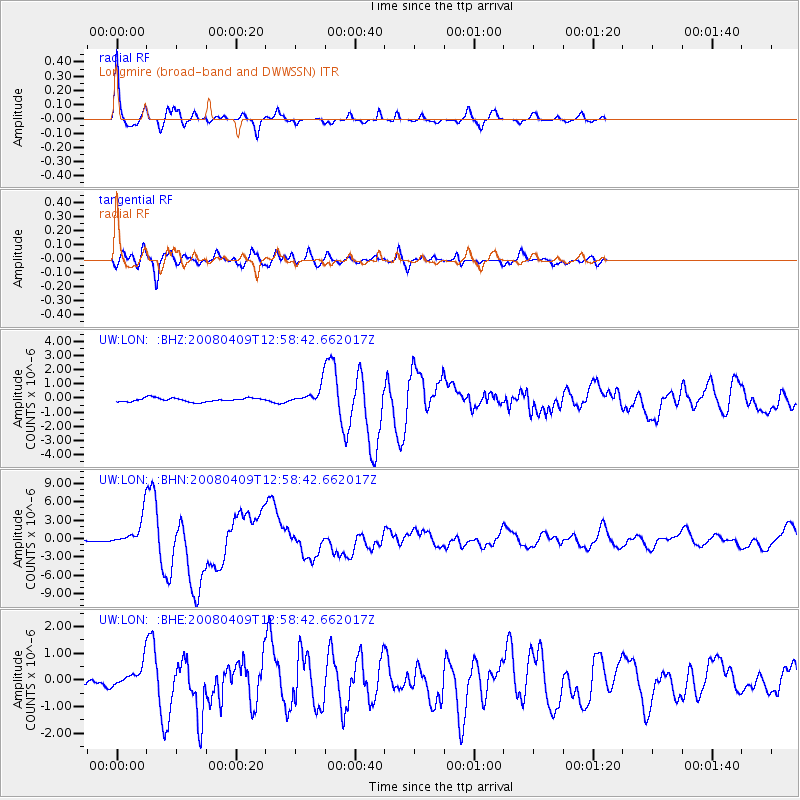
Signal To Noise
| Channel | StoN | STA | LTA |
| UW:LON: :BHN:20080409T12:58:42.662017Z | 15.533941 | 2.270881E-6 | 1.4618833E-7 |
| UW:LON: :BHE:20080409T12:58:42.662017Z | 2.3556528 | 3.8716163E-7 | 1.6435429E-7 |
| UW:LON: :BHZ:20080409T12:58:42.662017Z | 4.4890075 | 5.9768354E-7 | 1.3314381E-7 |
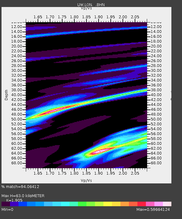
| Arrivals | |
| Ps | 8.8 SECOND |
| PpPs | 27 SECOND |
| PsPs/PpSs | 36 SECOND |

