You are here: Home > Network List > CI - Caltech Regional Seismic Network Stations List
> Station SLA SLA, Trona, CA, USA > Earthquake Result Viewer
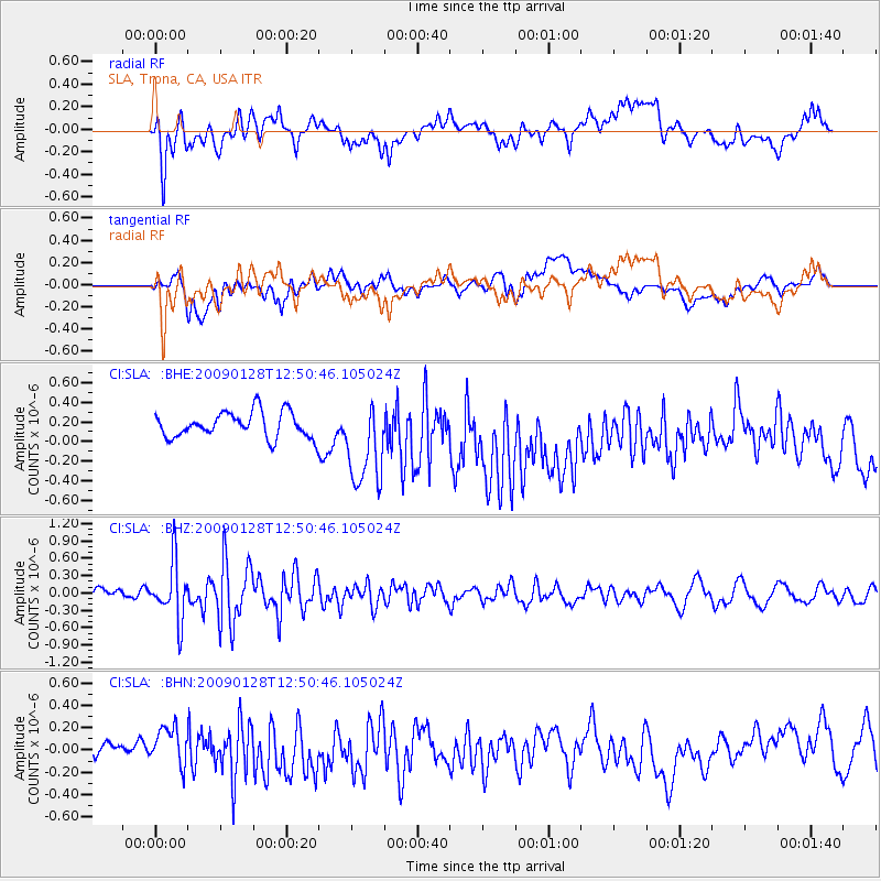
SLA SLA, Trona, CA, USA - Earthquake Result Viewer
*The percent match for this event was below the threshold and hence no stack was calculated.
| Earthquake location: |
Samoa Islands Region |
| Earthquake latitude/longitude: |
-17.0/-172.1 |
| Earthquake time(UTC): |
2009/01/28 (028) 12:39:42 GMT |
| Earthquake Depth: |
10 km |
| Earthquake Magnitude: |
5.6 MB, 5.3 MS, 5.5 MW |
| Earthquake Catalog/Contributor: |
WHDF/NEIC |
|
| Network: |
CI Caltech Regional Seismic Network |
| Station: |
SLA SLA, Trona, CA, USA |
| Lat/Lon: |
35.89 N/117.28 W |
| Elevation: |
1174 m |
|
| Distance: |
73.8 deg |
| Az: |
43.692 deg |
| Baz: |
234.5 deg |
| Ray Param: |
$rayparam |
*The percent match for this event was below the threshold and hence was not used in the summary stack. |
|
| Radial Match: |
57.491276 % |
| Radial Bump: |
400 |
| Transverse Match: |
56.859314 % |
| Transverse Bump: |
400 |
| SOD ConfigId: |
2658 |
| Insert Time: |
2010-02-25 20:35:20.491 +0000 |
| GWidth: |
2.5 |
| Max Bumps: |
400 |
| Tol: |
0.001 |
|
Signal To Noise
| Channel | StoN | STA | LTA |
| CI:SLA: :BHZ:20090128T12:50:46.105024Z | 4.2646294 | 5.0106377E-7 | 1.1749292E-7 |
| CI:SLA: :BHN:20090128T12:50:46.105024Z | 1.6262618 | 1.9892788E-7 | 1.2232218E-7 |
| CI:SLA: :BHE:20090128T12:50:46.105024Z | 3.48542 | 4.5604648E-7 | 1.3084406E-7 |
| Arrivals |
| Ps | |
| PpPs | |
| PsPs/PpSs | |


