You are here: Home > Network List > UW - Pacific Northwest Regional Seismic Network Stations List
> Station LON Longmire (broad-band and DWWSSN) > Earthquake Result Viewer
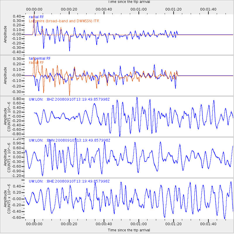
LON Longmire (broad-band and DWWSSN) - Earthquake Result Viewer
*The percent match for this event was below the threshold and hence no stack was calculated.
| Earthquake location: |
Central Mid-Atlantic Ridge |
| Earthquake latitude/longitude: |
8.1/-38.7 |
| Earthquake time(UTC): |
2008/09/10 (254) 13:08:14 GMT |
| Earthquake Depth: |
10 km |
| Earthquake Magnitude: |
6.3 MB, 6.5 MS, 6.6 MW, 6.6 MW |
| Earthquake Catalog/Contributor: |
WHDF/NEIC |
|
| Network: |
UW Pacific Northwest Regional Seismic Network |
| Station: |
LON Longmire (broad-band and DWWSSN) |
| Lat/Lon: |
46.75 N/121.81 W |
| Elevation: |
850 m |
|
| Distance: |
79.4 deg |
| Az: |
316.02 deg |
| Baz: |
89.435 deg |
| Ray Param: |
$rayparam |
*The percent match for this event was below the threshold and hence was not used in the summary stack. |
|
| Radial Match: |
71.64147 % |
| Radial Bump: |
400 |
| Transverse Match: |
62.40093 % |
| Transverse Bump: |
313 |
| SOD ConfigId: |
2560 |
| Insert Time: |
2010-02-27 04:46:55.703 +0000 |
| GWidth: |
2.5 |
| Max Bumps: |
400 |
| Tol: |
0.001 |
|
Signal To Noise
| Channel | StoN | STA | LTA |
| UW:LON: :BHN:20080910T13:19:49.857998Z | 2.8176346 | 4.2106836E-7 | 1.4944038E-7 |
| UW:LON: :BHE:20080910T13:19:49.857998Z | 0.7985921 | 1.7018331E-7 | 2.1310419E-7 |
| UW:LON: :BHZ:20080910T13:19:49.857998Z | 2.1214242 | 3.0980954E-7 | 1.4603846E-7 |
| Arrivals |
| Ps | |
| PpPs | |
| PsPs/PpSs | |


