You are here: Home > Network List > TA - USArray Transportable Network (new EarthScope stations) Stations List
> Station J01E Myrtle Point, OR, USA > Earthquake Result Viewer
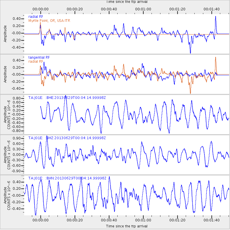
J01E Myrtle Point, OR, USA - Earthquake Result Viewer
*The percent match for this event was below the threshold and hence no stack was calculated.
| Earthquake location: |
Taiwan Region |
| Earthquake latitude/longitude: |
24.1/122.2 |
| Earthquake time(UTC): |
2013/06/28 (179) 23:51:49 GMT |
| Earthquake Depth: |
15 km |
| Earthquake Magnitude: |
5.7 MW, 5.5 MW, 5.5 MS, 5.6 MB |
| Earthquake Catalog/Contributor: |
NEIC PDE/NEIC PDE-W |
|
| Network: |
TA USArray Transportable Network (new EarthScope stations) |
| Station: |
J01E Myrtle Point, OR, USA |
| Lat/Lon: |
43.16 N/123.93 W |
| Elevation: |
128 m |
|
| Distance: |
89.6 deg |
| Az: |
42.014 deg |
| Baz: |
303.282 deg |
| Ray Param: |
$rayparam |
*The percent match for this event was below the threshold and hence was not used in the summary stack. |
|
| Radial Match: |
52.672543 % |
| Radial Bump: |
400 |
| Transverse Match: |
49.501186 % |
| Transverse Bump: |
400 |
| SOD ConfigId: |
512894 |
| Insert Time: |
2013-09-15 10:48:32.855 +0000 |
| GWidth: |
2.5 |
| Max Bumps: |
400 |
| Tol: |
0.001 |
|
Signal To Noise
| Channel | StoN | STA | LTA |
| TA:J01E: :BHZ:20130629T00:04:14.99998Z | 2.3622532 | 5.726465E-7 | 2.424154E-7 |
| TA:J01E: :BHN:20130629T00:04:14.99998Z | 1.4092729 | 3.5761988E-7 | 2.5376198E-7 |
| TA:J01E: :BHE:20130629T00:04:14.99998Z | 0.9671014 | 3.474158E-7 | 3.5923412E-7 |
| Arrivals |
| Ps | |
| PpPs | |
| PsPs/PpSs | |


