You are here: Home > Network List > UW - Pacific Northwest Regional Seismic Network Stations List
> Station MRBL Marblemount, WA, USA > Earthquake Result Viewer
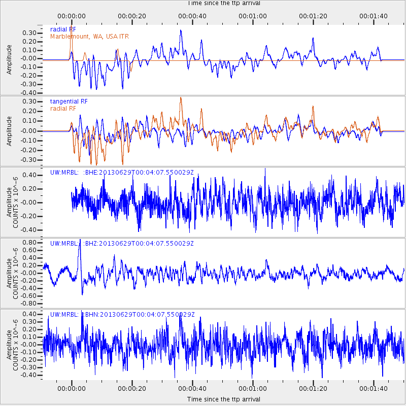
MRBL Marblemount, WA, USA - Earthquake Result Viewer
*The percent match for this event was below the threshold and hence no stack was calculated.
| Earthquake location: |
Taiwan Region |
| Earthquake latitude/longitude: |
24.1/122.2 |
| Earthquake time(UTC): |
2013/06/28 (179) 23:51:49 GMT |
| Earthquake Depth: |
15 km |
| Earthquake Magnitude: |
5.7 MW, 5.5 MW, 5.5 MS, 5.6 MB |
| Earthquake Catalog/Contributor: |
NEIC PDE/NEIC PDE-W |
|
| Network: |
UW Pacific Northwest Regional Seismic Network |
| Station: |
MRBL Marblemount, WA, USA |
| Lat/Lon: |
48.52 N/121.48 W |
| Elevation: |
75 m |
|
| Distance: |
88.0 deg |
| Az: |
36.618 deg |
| Baz: |
304.924 deg |
| Ray Param: |
$rayparam |
*The percent match for this event was below the threshold and hence was not used in the summary stack. |
|
| Radial Match: |
63.634945 % |
| Radial Bump: |
400 |
| Transverse Match: |
59.71178 % |
| Transverse Bump: |
400 |
| SOD ConfigId: |
512894 |
| Insert Time: |
2013-09-15 10:51:38.483 +0000 |
| GWidth: |
2.5 |
| Max Bumps: |
400 |
| Tol: |
0.001 |
|
Signal To Noise
| Channel | StoN | STA | LTA |
| UW:MRBL: :BHZ:20130629T00:04:07.550029Z | 2.7058642 | 3.357587E-7 | 1.2408556E-7 |
| UW:MRBL: :BHN:20130629T00:04:07.550029Z | 1.182535 | 1.5115192E-7 | 1.2782026E-7 |
| UW:MRBL: :BHE:20130629T00:04:07.550029Z | 1.0093995 | 1.3493086E-7 | 1.3367439E-7 |
| Arrivals |
| Ps | |
| PpPs | |
| PsPs/PpSs | |


