You are here: Home > Network List > WY - Yellowstone Wyoming Seismic Network Stations List
> Station YPP Pitchstone Plateau, YNP, WY, USA > Earthquake Result Viewer
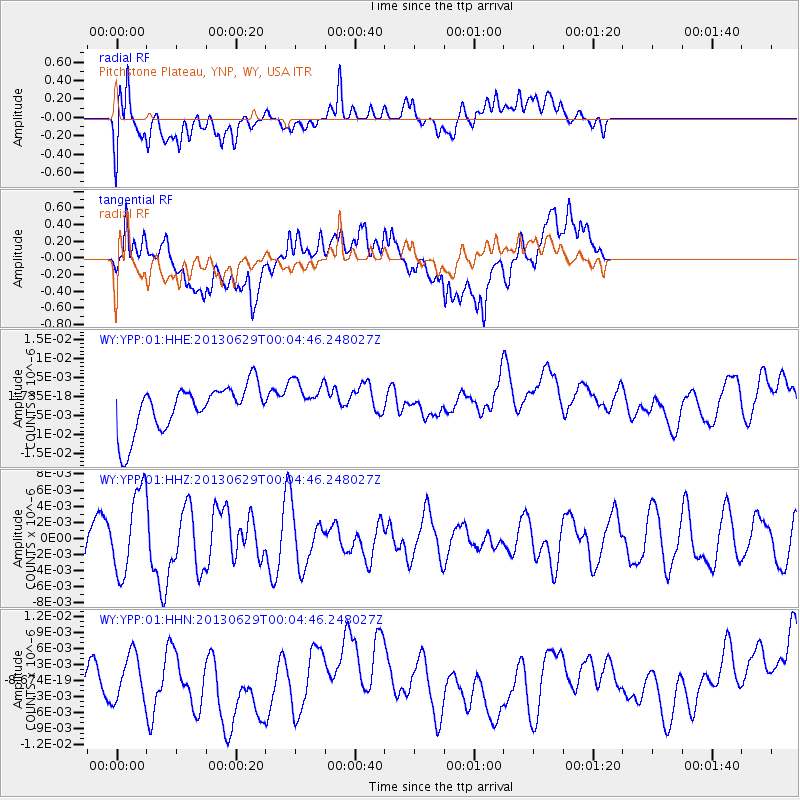
YPP Pitchstone Plateau, YNP, WY, USA - Earthquake Result Viewer
*The percent match for this event was below the threshold and hence no stack was calculated.
| Earthquake location: |
Taiwan Region |
| Earthquake latitude/longitude: |
24.1/122.2 |
| Earthquake time(UTC): |
2013/06/28 (179) 23:51:49 GMT |
| Earthquake Depth: |
15 km |
| Earthquake Magnitude: |
5.7 MW, 5.5 MW, 5.5 MS, 5.6 MB |
| Earthquake Catalog/Contributor: |
NEIC PDE/NEIC PDE-W |
|
| Network: |
WY Yellowstone Wyoming Seismic Network |
| Station: |
YPP Pitchstone Plateau, YNP, WY, USA |
| Lat/Lon: |
44.27 N/110.80 W |
| Elevation: |
2707 m |
|
| Distance: |
96.5 deg |
| Az: |
35.287 deg |
| Baz: |
312.701 deg |
| Ray Param: |
$rayparam |
*The percent match for this event was below the threshold and hence was not used in the summary stack. |
|
| Radial Match: |
41.41836 % |
| Radial Bump: |
400 |
| Transverse Match: |
57.34178 % |
| Transverse Bump: |
400 |
| SOD ConfigId: |
512894 |
| Insert Time: |
2013-09-15 10:52:47.563 +0000 |
| GWidth: |
2.5 |
| Max Bumps: |
400 |
| Tol: |
0.001 |
|
Signal To Noise
| Channel | StoN | STA | LTA |
| WY:YPP:01:HHZ:20130629T00:04:46.248027Z | 1.7386147 | 5.1005618E-9 | 2.933693E-9 |
| WY:YPP:01:HHN:20130629T00:04:46.248027Z | 1.2128764 | 4.809599E-9 | 3.9654484E-9 |
| WY:YPP:01:HHE:20130629T00:04:46.248027Z | 0.88434124 | 5.36418E-9 | 6.0657355E-9 |
| Arrivals |
| Ps | |
| PpPs | |
| PsPs/PpSs | |


