HEH Heihe,Heilongjiang Province - Earthquake Result Viewer
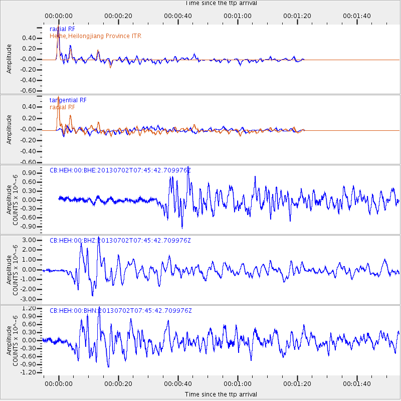
Earthquake location: Northern Sumatra, Indonesia
Earthquake latitude/longitude: 4.6/96.7
Earthquake time(UTC): 2013/07/02 (183) 07:37:02 GMT
Earthquake Depth: 13 km
Earthquake Magnitude: 6.1 MW, 5.9 MB, 6.1 MW, 6.2 MS
Earthquake Catalog/Contributor: NEIC PDE/NEIC PDE-W
Network: CB China National Seismic Network
Station: HEH Heihe,Heilongjiang Province
Lat/Lon: 50.25 N/127.41 E
Elevation: 165 m
Distance: 52.3 deg
Az: 24.506 deg
Baz: 220.096 deg
Ray Param: 0.06684405
Estimated Moho Depth: 33.25 km
Estimated Crust Vp/Vs: 1.77
Assumed Crust Vp: 6.419 km/s
Estimated Crust Vs: 3.632 km/s
Estimated Crust Poisson's Ratio: 0.26
Radial Match: 93.55991 %
Radial Bump: 400
Transverse Match: 75.21422 %
Transverse Bump: 400
SOD ConfigId: 512894
Insert Time: 2013-09-15 10:56:34.571 +0000
GWidth: 2.5
Max Bumps: 400
Tol: 0.001

Signal To Noise

ChannelStoNSTALTA
CB:HEH:00:BHZ:20130702T07:45:42.709976Z3.88760692.3661975E-76.086515E-8
CB:HEH:00:BHN:20130702T07:45:42.709976Z1.00083821.0465113E-71.0456348E-7
CB:HEH:00:BHE:20130702T07:45:42.709976Z1.56212359.056093E-85.7972965E-8
Arrivals
Ps4.2 SECOND
PpPs14 SECOND
PsPs/PpSs18 SECOND