You are here: Home > Network List > UW - Pacific Northwest Regional Seismic Network Stations List
> Station LON Longmire (broad-band and DWWSSN) > Earthquake Result Viewer
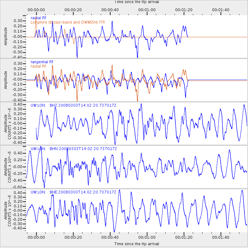
LON Longmire (broad-band and DWWSSN) - Earthquake Result Viewer
*The percent match for this event was below the threshold and hence no stack was calculated.
| Earthquake location: |
Philippine Islands Region |
| Earthquake latitude/longitude: |
19.9/121.3 |
| Earthquake time(UTC): |
2008/03/03 (063) 13:49:40 GMT |
| Earthquake Depth: |
10 km |
| Earthquake Magnitude: |
6.0 MB, 6.0 MW, 5.9 MW |
| Earthquake Catalog/Contributor: |
WHDF/NEIC |
|
| Network: |
UW Pacific Northwest Regional Seismic Network |
| Station: |
LON Longmire (broad-band and DWWSSN) |
| Lat/Lon: |
46.75 N/121.81 W |
| Elevation: |
850 m |
|
| Distance: |
92.7 deg |
| Az: |
37.888 deg |
| Baz: |
302.822 deg |
| Ray Param: |
$rayparam |
*The percent match for this event was below the threshold and hence was not used in the summary stack. |
|
| Radial Match: |
82.89702 % |
| Radial Bump: |
400 |
| Transverse Match: |
60.53628 % |
| Transverse Bump: |
400 |
| SOD ConfigId: |
2504 |
| Insert Time: |
2010-02-27 04:47:19.576 +0000 |
| GWidth: |
2.5 |
| Max Bumps: |
400 |
| Tol: |
0.001 |
|
Signal To Noise
| Channel | StoN | STA | LTA |
| UW:LON: :BHN:20080303T14:02:20.737017Z | 1.863567 | 3.991738E-7 | 2.141988E-7 |
| UW:LON: :BHE:20080303T14:02:20.737017Z | 0.6006323 | 1.13186374E-7 | 1.8844537E-7 |
| UW:LON: :BHZ:20080303T14:02:20.737017Z | 0.9300887 | 1.3255462E-7 | 1.4251826E-7 |
| Arrivals |
| Ps | |
| PpPs | |
| PsPs/PpSs | |


