You are here: Home > Network List > TA - USArray Transportable Network (new EarthScope stations) Stations List
> Station G03D McMinnville, OR, USA > Earthquake Result Viewer
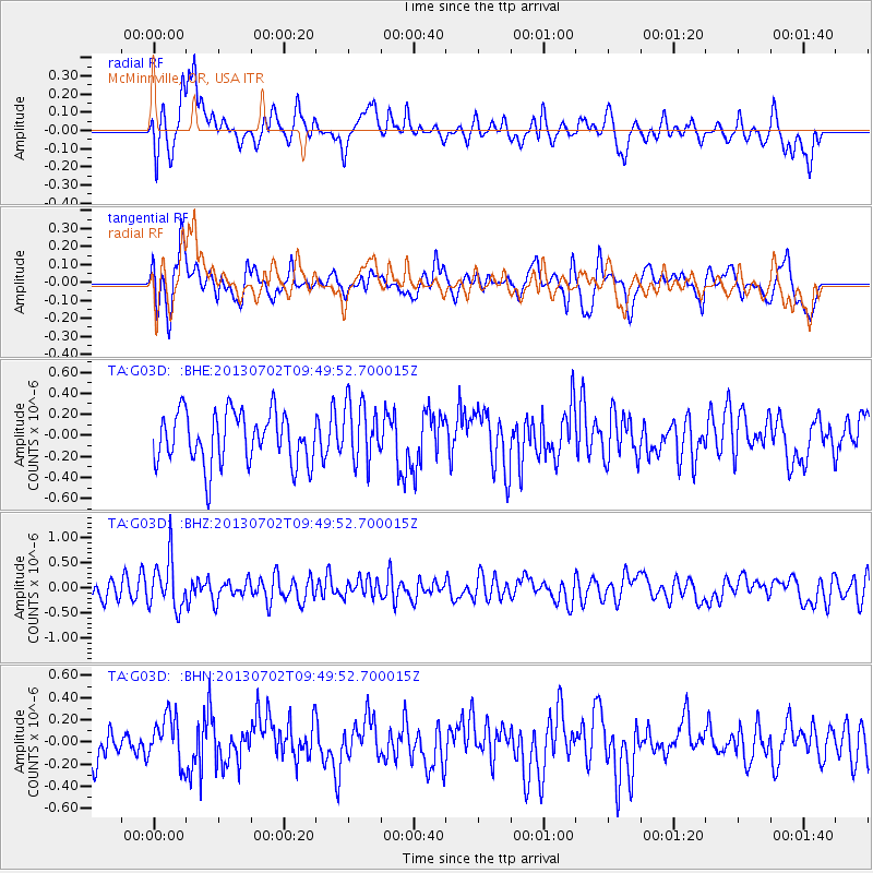
G03D McMinnville, OR, USA - Earthquake Result Viewer
*The percent match for this event was below the threshold and hence no stack was calculated.
| Earthquake location: |
Tonga Islands |
| Earthquake latitude/longitude: |
-15.7/-173.8 |
| Earthquake time(UTC): |
2013/07/02 (183) 09:38:41 GMT |
| Earthquake Depth: |
47 km |
| Earthquake Magnitude: |
5.5 MW, 5.6 MB |
| Earthquake Catalog/Contributor: |
NEIC PDE/NEIC PDE-W |
|
| Network: |
TA USArray Transportable Network (new EarthScope stations) |
| Station: |
G03D McMinnville, OR, USA |
| Lat/Lon: |
45.21 N/123.26 W |
| Elevation: |
222 m |
|
| Distance: |
76.0 deg |
| Az: |
34.228 deg |
| Baz: |
230.025 deg |
| Ray Param: |
$rayparam |
*The percent match for this event was below the threshold and hence was not used in the summary stack. |
|
| Radial Match: |
60.725304 % |
| Radial Bump: |
400 |
| Transverse Match: |
54.059208 % |
| Transverse Bump: |
400 |
| SOD ConfigId: |
512894 |
| Insert Time: |
2013-09-15 11:25:01.630 +0000 |
| GWidth: |
2.5 |
| Max Bumps: |
400 |
| Tol: |
0.001 |
|
Signal To Noise
| Channel | StoN | STA | LTA |
| TA:G03D: :BHZ:20130702T09:49:52.700015Z | 2.2757711 | 4.984742E-7 | 2.190353E-7 |
| TA:G03D: :BHN:20130702T09:49:52.700015Z | 1.509324 | 2.1554625E-7 | 1.428098E-7 |
| TA:G03D: :BHE:20130702T09:49:52.700015Z | 1.162058 | 2.8603768E-7 | 2.461475E-7 |
| Arrivals |
| Ps | |
| PpPs | |
| PsPs/PpSs | |


