You are here: Home > Network List > TA - USArray Transportable Network (new EarthScope stations) Stations List
> Station L04D Klamath Falls, OR, USA > Earthquake Result Viewer
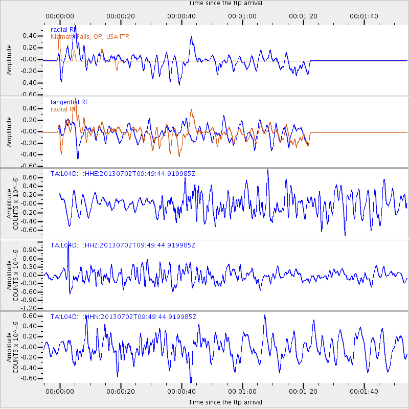
L04D Klamath Falls, OR, USA - Earthquake Result Viewer
*The percent match for this event was below the threshold and hence no stack was calculated.
| Earthquake location: |
Tonga Islands |
| Earthquake latitude/longitude: |
-15.7/-173.8 |
| Earthquake time(UTC): |
2013/07/02 (183) 09:38:41 GMT |
| Earthquake Depth: |
47 km |
| Earthquake Magnitude: |
5.5 MW, 5.6 MB |
| Earthquake Catalog/Contributor: |
NEIC PDE/NEIC PDE-W |
|
| Network: |
TA USArray Transportable Network (new EarthScope stations) |
| Station: |
L04D Klamath Falls, OR, USA |
| Lat/Lon: |
42.22 N/122.30 W |
| Elevation: |
1437 m |
|
| Distance: |
74.6 deg |
| Az: |
37.078 deg |
| Baz: |
231.409 deg |
| Ray Param: |
$rayparam |
*The percent match for this event was below the threshold and hence was not used in the summary stack. |
|
| Radial Match: |
70.590706 % |
| Radial Bump: |
400 |
| Transverse Match: |
67.736145 % |
| Transverse Bump: |
357 |
| SOD ConfigId: |
512894 |
| Insert Time: |
2013-09-15 11:26:12.748 +0000 |
| GWidth: |
2.5 |
| Max Bumps: |
400 |
| Tol: |
0.001 |
|
Signal To Noise
| Channel | StoN | STA | LTA |
| TA:L04D: :HHZ:20130702T09:49:44.919985Z | 4.338494 | 3.7170233E-7 | 8.567543E-8 |
| TA:L04D: :HHN:20130702T09:49:44.919985Z | 1.1609167 | 1.3145441E-7 | 1.1323329E-7 |
| TA:L04D: :HHE:20130702T09:49:44.919985Z | 0.985608 | 1.6157561E-7 | 1.6393497E-7 |
| Arrivals |
| Ps | |
| PpPs | |
| PsPs/PpSs | |


