You are here: Home > Network List > TA - USArray Transportable Network (new EarthScope stations) Stations List
> Station M04C Macdoel, CA, USA > Earthquake Result Viewer
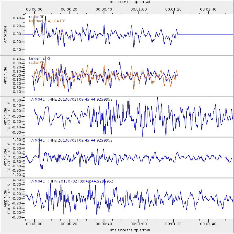
M04C Macdoel, CA, USA - Earthquake Result Viewer
*The percent match for this event was below the threshold and hence no stack was calculated.
| Earthquake location: |
Tonga Islands |
| Earthquake latitude/longitude: |
-15.7/-173.8 |
| Earthquake time(UTC): |
2013/07/02 (183) 09:38:41 GMT |
| Earthquake Depth: |
47 km |
| Earthquake Magnitude: |
5.5 MW, 5.6 MB |
| Earthquake Catalog/Contributor: |
NEIC PDE/NEIC PDE-W |
|
| Network: |
TA USArray Transportable Network (new EarthScope stations) |
| Station: |
M04C Macdoel, CA, USA |
| Lat/Lon: |
41.78 N/121.84 W |
| Elevation: |
1391 m |
|
| Distance: |
74.6 deg |
| Az: |
37.655 deg |
| Baz: |
231.872 deg |
| Ray Param: |
$rayparam |
*The percent match for this event was below the threshold and hence was not used in the summary stack. |
|
| Radial Match: |
54.33281 % |
| Radial Bump: |
400 |
| Transverse Match: |
58.342857 % |
| Transverse Bump: |
400 |
| SOD ConfigId: |
512894 |
| Insert Time: |
2013-09-15 11:26:24.411 +0000 |
| GWidth: |
2.5 |
| Max Bumps: |
400 |
| Tol: |
0.001 |
|
Signal To Noise
| Channel | StoN | STA | LTA |
| TA:M04C: :HHZ:20130702T09:49:44.929995Z | 2.592058 | 4.5097602E-7 | 1.7398378E-7 |
| TA:M04C: :HHN:20130702T09:49:44.929995Z | 1.3214041 | 2.2294904E-7 | 1.6872131E-7 |
| TA:M04C: :HHE:20130702T09:49:44.929995Z | 1.249175 | 2.2799858E-7 | 1.8251933E-7 |
| Arrivals |
| Ps | |
| PpPs | |
| PsPs/PpSs | |


