You are here: Home > Network List > TA - USArray Transportable Network (new EarthScope stations) Stations List
> Station O03E Paynes Creek, CA, USA > Earthquake Result Viewer
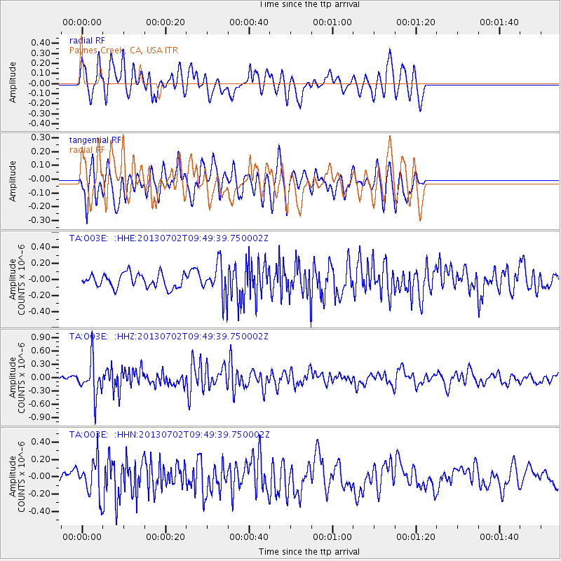
O03E Paynes Creek, CA, USA - Earthquake Result Viewer
*The percent match for this event was below the threshold and hence no stack was calculated.
| Earthquake location: |
Tonga Islands |
| Earthquake latitude/longitude: |
-15.7/-173.8 |
| Earthquake time(UTC): |
2013/07/02 (183) 09:38:41 GMT |
| Earthquake Depth: |
47 km |
| Earthquake Magnitude: |
5.5 MW, 5.6 MB |
| Earthquake Catalog/Contributor: |
NEIC PDE/NEIC PDE-W |
|
| Network: |
TA USArray Transportable Network (new EarthScope stations) |
| Station: |
O03E Paynes Creek, CA, USA |
| Lat/Lon: |
40.29 N/121.80 W |
| Elevation: |
967 m |
|
| Distance: |
73.7 deg |
| Az: |
38.891 deg |
| Baz: |
232.233 deg |
| Ray Param: |
$rayparam |
*The percent match for this event was below the threshold and hence was not used in the summary stack. |
|
| Radial Match: |
53.234005 % |
| Radial Bump: |
400 |
| Transverse Match: |
55.874985 % |
| Transverse Bump: |
400 |
| SOD ConfigId: |
512894 |
| Insert Time: |
2013-09-15 11:27:02.853 +0000 |
| GWidth: |
2.5 |
| Max Bumps: |
400 |
| Tol: |
0.001 |
|
Signal To Noise
| Channel | StoN | STA | LTA |
| TA:O03E: :HHZ:20130702T09:49:39.750002Z | 3.3565779 | 3.952E-7 | 1.1773896E-7 |
| TA:O03E: :HHN:20130702T09:49:39.750002Z | 1.5544745 | 2.085196E-7 | 1.3414153E-7 |
| TA:O03E: :HHE:20130702T09:49:39.750002Z | 2.4838765 | 2.1325337E-7 | 8.5855056E-8 |
| Arrivals |
| Ps | |
| PpPs | |
| PsPs/PpSs | |


