You are here: Home > Network List > TA - USArray Transportable Network (new EarthScope stations) Stations List
> Station O02D Mt. Diablo Meridian, CA, USA > Earthquake Result Viewer
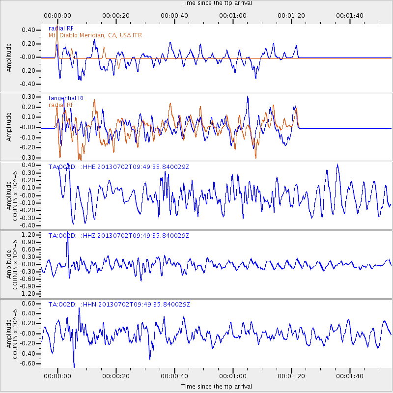
O02D Mt. Diablo Meridian, CA, USA - Earthquake Result Viewer
*The percent match for this event was below the threshold and hence no stack was calculated.
| Earthquake location: |
Tonga Islands |
| Earthquake latitude/longitude: |
-15.7/-173.8 |
| Earthquake time(UTC): |
2013/07/02 (183) 09:38:41 GMT |
| Earthquake Depth: |
47 km |
| Earthquake Magnitude: |
5.5 MW, 5.6 MB |
| Earthquake Catalog/Contributor: |
NEIC PDE/NEIC PDE-W |
|
| Network: |
TA USArray Transportable Network (new EarthScope stations) |
| Station: |
O02D Mt. Diablo Meridian, CA, USA |
| Lat/Lon: |
40.18 N/122.79 W |
| Elevation: |
965 m |
|
| Distance: |
73.1 deg |
| Az: |
38.501 deg |
| Baz: |
231.487 deg |
| Ray Param: |
$rayparam |
*The percent match for this event was below the threshold and hence was not used in the summary stack. |
|
| Radial Match: |
59.90529 % |
| Radial Bump: |
384 |
| Transverse Match: |
47.319496 % |
| Transverse Bump: |
400 |
| SOD ConfigId: |
512894 |
| Insert Time: |
2013-09-15 11:27:04.645 +0000 |
| GWidth: |
2.5 |
| Max Bumps: |
400 |
| Tol: |
0.001 |
|
Signal To Noise
| Channel | StoN | STA | LTA |
| TA:O02D: :HHZ:20130702T09:49:35.840029Z | 2.5587854 | 3.9011707E-7 | 1.5246181E-7 |
| TA:O02D: :HHN:20130702T09:49:35.840029Z | 1.2012147 | 1.6507605E-7 | 1.3742427E-7 |
| TA:O02D: :HHE:20130702T09:49:35.840029Z | 0.56817293 | 1.04119366E-7 | 1.8325295E-7 |
| Arrivals |
| Ps | |
| PpPs | |
| PsPs/PpSs | |


