You are here: Home > Network List > US - United States National Seismic Network Stations List
> Station WMOK Wichita Mountains, Oklahoma, USA > Earthquake Result Viewer
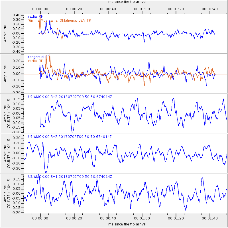
WMOK Wichita Mountains, Oklahoma, USA - Earthquake Result Viewer
*The percent match for this event was below the threshold and hence no stack was calculated.
| Earthquake location: |
Tonga Islands |
| Earthquake latitude/longitude: |
-15.7/-173.8 |
| Earthquake time(UTC): |
2013/07/02 (183) 09:38:41 GMT |
| Earthquake Depth: |
47 km |
| Earthquake Magnitude: |
5.5 MW, 5.6 MB |
| Earthquake Catalog/Contributor: |
NEIC PDE/NEIC PDE-W |
|
| Network: |
US United States National Seismic Network |
| Station: |
WMOK Wichita Mountains, Oklahoma, USA |
| Lat/Lon: |
34.74 N/98.78 W |
| Elevation: |
486 m |
|
| Distance: |
87.0 deg |
| Az: |
52.813 deg |
| Baz: |
248.684 deg |
| Ray Param: |
$rayparam |
*The percent match for this event was below the threshold and hence was not used in the summary stack. |
|
| Radial Match: |
68.94563 % |
| Radial Bump: |
400 |
| Transverse Match: |
62.792805 % |
| Transverse Bump: |
400 |
| SOD ConfigId: |
512894 |
| Insert Time: |
2013-09-15 11:31:40.054 +0000 |
| GWidth: |
2.5 |
| Max Bumps: |
400 |
| Tol: |
0.001 |
|
Signal To Noise
| Channel | StoN | STA | LTA |
| US:WMOK:00:BHZ:20130702T09:50:50.674014Z | 1.6575613 | 2.1254367E-7 | 1.2822673E-7 |
| US:WMOK:00:BH1:20130702T09:50:50.674014Z | 1.7619689 | 9.23411E-8 | 5.2407906E-8 |
| US:WMOK:00:BH2:20130702T09:50:50.674014Z | 0.88317907 | 7.077494E-8 | 8.0136566E-8 |
| Arrivals |
| Ps | |
| PpPs | |
| PsPs/PpSs | |


