You are here: Home > Network List > UU - University of Utah Regional Network Stations List
> Station CCUT Cedar City, UT, USA > Earthquake Result Viewer
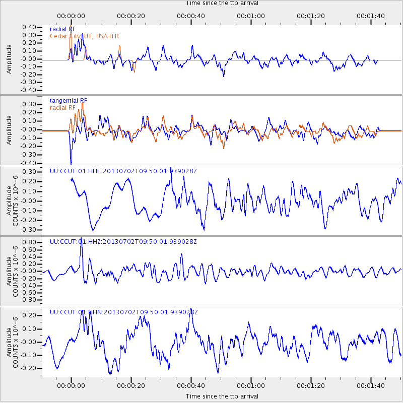
CCUT Cedar City, UT, USA - Earthquake Result Viewer
*The percent match for this event was below the threshold and hence no stack was calculated.
| Earthquake location: |
Tonga Islands |
| Earthquake latitude/longitude: |
-15.7/-173.8 |
| Earthquake time(UTC): |
2013/07/02 (183) 09:38:41 GMT |
| Earthquake Depth: |
47 km |
| Earthquake Magnitude: |
5.5 MW, 5.6 MB |
| Earthquake Catalog/Contributor: |
NEIC PDE/NEIC PDE-W |
|
| Network: |
UU University of Utah Regional Network |
| Station: |
CCUT Cedar City, UT, USA |
| Lat/Lon: |
37.55 N/113.36 W |
| Elevation: |
2127 m |
|
| Distance: |
77.6 deg |
| Az: |
45.053 deg |
| Baz: |
239.047 deg |
| Ray Param: |
$rayparam |
*The percent match for this event was below the threshold and hence was not used in the summary stack. |
|
| Radial Match: |
45.7236 % |
| Radial Bump: |
374 |
| Transverse Match: |
63.159737 % |
| Transverse Bump: |
400 |
| SOD ConfigId: |
512894 |
| Insert Time: |
2013-09-15 11:32:00.467 +0000 |
| GWidth: |
2.5 |
| Max Bumps: |
400 |
| Tol: |
0.001 |
|
Signal To Noise
| Channel | StoN | STA | LTA |
| UU:CCUT:01:HHZ:20130702T09:50:01.939028Z | 3.41952 | 3.236362E-7 | 9.464375E-8 |
| UU:CCUT:01:HHN:20130702T09:50:01.939028Z | 1.3444306 | 1.0995625E-7 | 8.1786474E-8 |
| UU:CCUT:01:HHE:20130702T09:50:01.939028Z | 1.0173817 | 1.5212059E-7 | 1.4952165E-7 |
| Arrivals |
| Ps | |
| PpPs | |
| PsPs/PpSs | |


