You are here: Home > Network List > WY - Yellowstone Wyoming Seismic Network Stations List
> Station YHH Holmes Hill, YNP, WY, USA > Earthquake Result Viewer
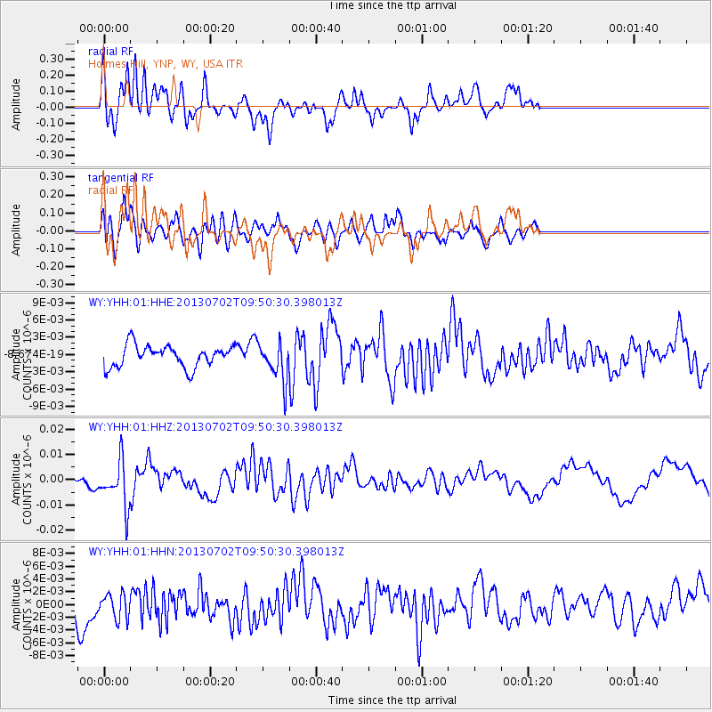
YHH Holmes Hill, YNP, WY, USA - Earthquake Result Viewer
*The percent match for this event was below the threshold and hence no stack was calculated.
| Earthquake location: |
Tonga Islands |
| Earthquake latitude/longitude: |
-15.7/-173.8 |
| Earthquake time(UTC): |
2013/07/02 (183) 09:38:41 GMT |
| Earthquake Depth: |
47 km |
| Earthquake Magnitude: |
5.5 MW, 5.6 MB |
| Earthquake Catalog/Contributor: |
NEIC PDE/NEIC PDE-W |
|
| Network: |
WY Yellowstone Wyoming Seismic Network |
| Station: |
YHH Holmes Hill, YNP, WY, USA |
| Lat/Lon: |
44.79 N/110.85 W |
| Elevation: |
2717 m |
|
| Distance: |
83.0 deg |
| Az: |
39.72 deg |
| Baz: |
239.797 deg |
| Ray Param: |
$rayparam |
*The percent match for this event was below the threshold and hence was not used in the summary stack. |
|
| Radial Match: |
71.745445 % |
| Radial Bump: |
400 |
| Transverse Match: |
75.44576 % |
| Transverse Bump: |
400 |
| SOD ConfigId: |
512894 |
| Insert Time: |
2013-09-15 11:34:27.649 +0000 |
| GWidth: |
2.5 |
| Max Bumps: |
400 |
| Tol: |
0.001 |
|
Signal To Noise
| Channel | StoN | STA | LTA |
| WY:YHH:01:HHZ:20130702T09:50:30.398013Z | 3.5292795 | 9.111904E-9 | 2.581803E-9 |
| WY:YHH:01:HHN:20130702T09:50:30.398013Z | 1.0749385 | 1.9612587E-9 | 1.8245311E-9 |
| WY:YHH:01:HHE:20130702T09:50:30.398013Z | 1.7483393 | 3.3055234E-9 | 1.8906647E-9 |
| Arrivals |
| Ps | |
| PpPs | |
| PsPs/PpSs | |


