
LTY Liberty (broad-band) - Earthquake Result Viewer
| ||||||||||||||||||
| ||||||||||||||||||
| ||||||||||||||||||
|
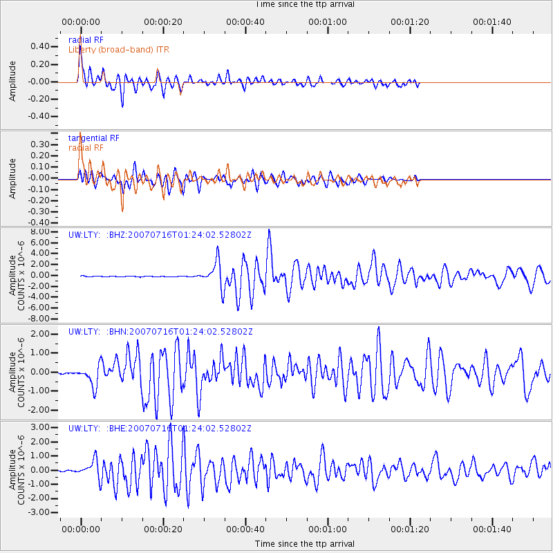
Signal To Noise
| Channel | StoN | STA | LTA |
| UW:LTY: :BHN:20070716T01:24:02.52802Z | 15.485184 | 5.577082E-7 | 3.60156E-8 |
| UW:LTY: :BHE:20070716T01:24:02.52802Z | 19.539124 | 6.380563E-7 | 3.265532E-8 |
| UW:LTY: :BHZ:20070716T01:24:02.52802Z | 36.433308 | 2.4455726E-6 | 6.712464E-8 |
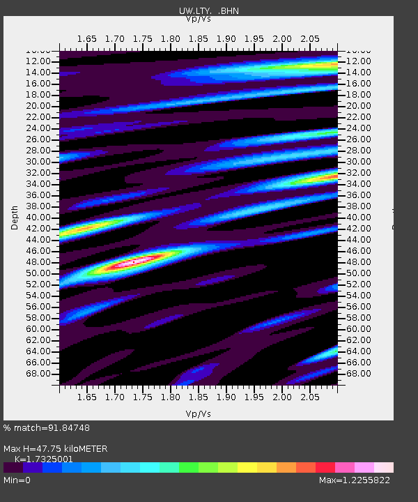
| Arrivals | |
| Ps | 5.5 SECOND |
| PpPs | 19 SECOND |
| PsPs/PpSs | 25 SECOND |

