You are here: Home > Network List > G - GEOSCOPE Stations List
> Station NOUC Port Laguerre, New Caledonia > Earthquake Result Viewer
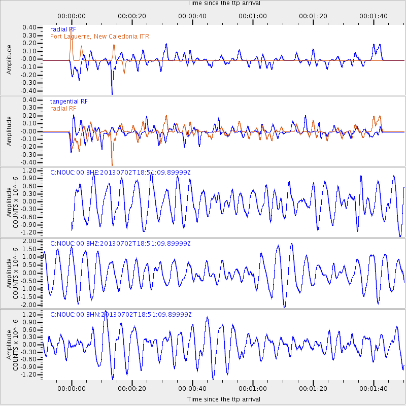
NOUC Port Laguerre, New Caledonia - Earthquake Result Viewer
*The percent match for this event was below the threshold and hence no stack was calculated.
| Earthquake location: |
Southeast Of Easter Island |
| Earthquake latitude/longitude: |
-35.9/-103.0 |
| Earthquake time(UTC): |
2013/07/02 (183) 18:39:43 GMT |
| Earthquake Depth: |
10 km |
| Earthquake Magnitude: |
5.7 MW, 5.5 MW |
| Earthquake Catalog/Contributor: |
NEIC PDE/NEIC PDE-W |
|
| Network: |
G GEOSCOPE |
| Station: |
NOUC Port Laguerre, New Caledonia |
| Lat/Lon: |
22.10 S/166.30 E |
| Elevation: |
112 m |
|
| Distance: |
77.9 deg |
| Az: |
251.485 deg |
| Baz: |
123.914 deg |
| Ray Param: |
$rayparam |
*The percent match for this event was below the threshold and hence was not used in the summary stack. |
|
| Radial Match: |
58.983086 % |
| Radial Bump: |
400 |
| Transverse Match: |
55.097015 % |
| Transverse Bump: |
400 |
| SOD ConfigId: |
512894 |
| Insert Time: |
2013-09-15 11:51:14.520 +0000 |
| GWidth: |
2.5 |
| Max Bumps: |
400 |
| Tol: |
0.001 |
|
Signal To Noise
| Channel | StoN | STA | LTA |
| G:NOUC:00:BHZ:20130702T18:51:09.89999Z | 1.771032 | 1.2134369E-6 | 6.851581E-7 |
| G:NOUC:00:BHN:20130702T18:51:09.89999Z | 0.46189618 | 1.3501378E-7 | 2.9230333E-7 |
| G:NOUC:00:BHE:20130702T18:51:09.89999Z | 0.7230931 | 4.5343316E-7 | 6.270744E-7 |
| Arrivals |
| Ps | |
| PpPs | |
| PsPs/PpSs | |


