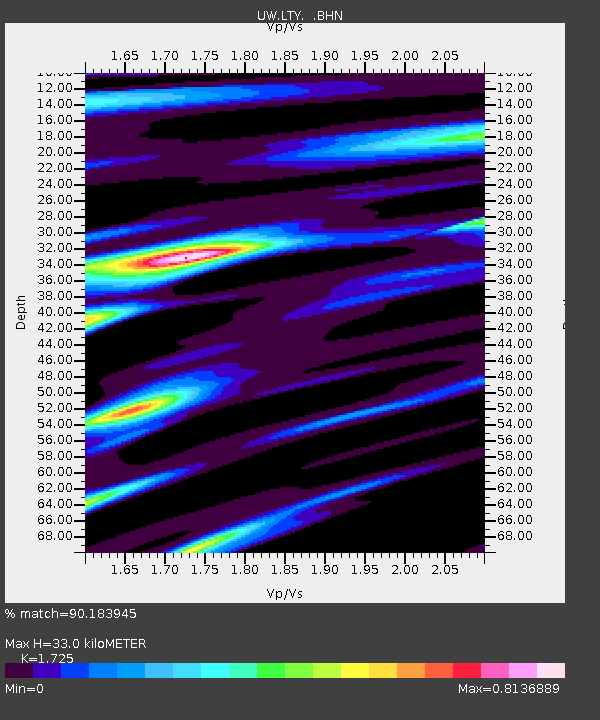
LTY Liberty (broad-band) - Earthquake Result Viewer

Earthquake location: Pakistan
Earthquake latitude/longitude: 34.5/73.6
Earthquake time(UTC): 2005/10/08 (281) 03:50:40 GMT
Earthquake Depth: 26 km
Earthquake Magnitude: 6.9 MB, 7.7 MS, 7.6 MW, 7.3 MW
Earthquake Catalog/Contributor: WHDF/NEIC
Network: UW Pacific Northwest Regional Seismic Network
Station: LTY Liberty (broad-band)
Lat/Lon: 47.26 N/120.66 W
Elevation: 970 m
Distance: 97.6 deg
Az: 9.74 deg
Baz: 348.169 deg
Ray Param: 0.04016201
Estimated Moho Depth: 33.0 km
Estimated Crust Vp/Vs: 1.73
Assumed Crust Vp: 6.597 km/s
Estimated Crust Vs: 3.825 km/s
Estimated Crust Poisson's Ratio: 0.25
Radial Match: 90.183945 %
Radial Bump: 400
Transverse Match: 74.623795 %
Transverse Bump: 400
SOD ConfigId: 2669
Insert Time: 2010-02-27 04:48:33.275 +0000
GWidth: 2.5
Max Bumps: 400
Tol: 0.001

Signal To Noise

ChannelStoNSTALTA
UW:LTY: :BHN:20051008T04:03:41.036023Z2.90565926.822315E-72.3479406E-7
UW:LTY: :BHE:20051008T04:03:41.036023Z0.749894562.698109E-73.5979846E-7
UW:LTY: :BHZ:20051008T04:03:41.036023Z7.0831112.6545895E-63.7477733E-7
Arrivals
Ps3.7 SECOND
PpPs13 SECOND
PsPs/PpSs17 SECOND