You are here: Home > Network List > TA - USArray Transportable Network (new EarthScope stations) Stations List
> Station H43A Windswept, Luxemburg, WI, USA > Earthquake Result Viewer
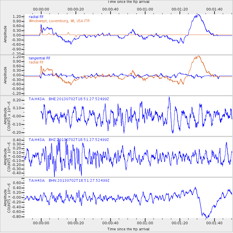
H43A Windswept, Luxemburg, WI, USA - Earthquake Result Viewer
*The percent match for this event was below the threshold and hence no stack was calculated.
| Earthquake location: |
Southeast Of Easter Island |
| Earthquake latitude/longitude: |
-35.9/-103.0 |
| Earthquake time(UTC): |
2013/07/02 (183) 18:39:43 GMT |
| Earthquake Depth: |
10 km |
| Earthquake Magnitude: |
5.7 MW, 5.5 MW |
| Earthquake Catalog/Contributor: |
NEIC PDE/NEIC PDE-W |
|
| Network: |
TA USArray Transportable Network (new EarthScope stations) |
| Station: |
H43A Windswept, Luxemburg, WI, USA |
| Lat/Lon: |
44.47 N/87.77 W |
| Elevation: |
274 m |
|
| Distance: |
81.2 deg |
| Az: |
10.946 deg |
| Baz: |
192.43 deg |
| Ray Param: |
$rayparam |
*The percent match for this event was below the threshold and hence was not used in the summary stack. |
|
| Radial Match: |
37.905903 % |
| Radial Bump: |
400 |
| Transverse Match: |
55.011936 % |
| Transverse Bump: |
400 |
| SOD ConfigId: |
512894 |
| Insert Time: |
2013-09-15 12:05:05.302 +0000 |
| GWidth: |
2.5 |
| Max Bumps: |
400 |
| Tol: |
0.001 |
|
Signal To Noise
| Channel | StoN | STA | LTA |
| TA:H43A: :BHZ:20130702T18:51:27.52499Z | 1.5888003 | 1.5878831E-7 | 9.994228E-8 |
| TA:H43A: :BHN:20130702T18:51:27.52499Z | 2.116536 | 1.3798804E-7 | 6.519523E-8 |
| TA:H43A: :BHE:20130702T18:51:27.52499Z | 1.0659637 | 6.176249E-8 | 5.7940515E-8 |
| Arrivals |
| Ps | |
| PpPs | |
| PsPs/PpSs | |


