You are here: Home > Network List > TA - USArray Transportable Network (new EarthScope stations) Stations List
> Station J49A Marlette, MI, USA > Earthquake Result Viewer
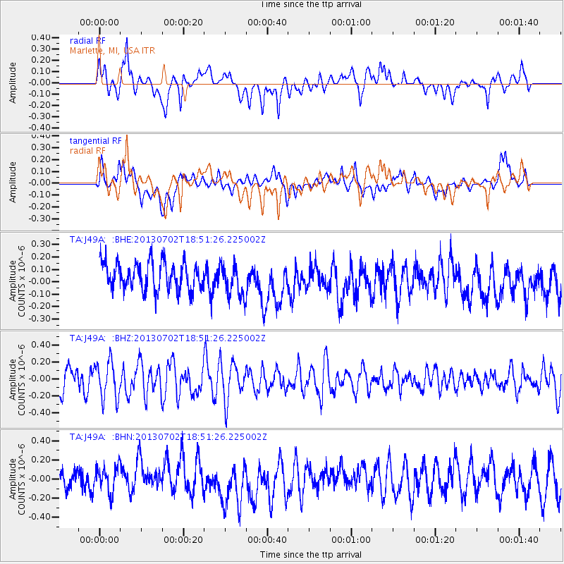
J49A Marlette, MI, USA - Earthquake Result Viewer
*The percent match for this event was below the threshold and hence no stack was calculated.
| Earthquake location: |
Southeast Of Easter Island |
| Earthquake latitude/longitude: |
-35.9/-103.0 |
| Earthquake time(UTC): |
2013/07/02 (183) 18:39:43 GMT |
| Earthquake Depth: |
10 km |
| Earthquake Magnitude: |
5.7 MW, 5.5 MW |
| Earthquake Catalog/Contributor: |
NEIC PDE/NEIC PDE-W |
|
| Network: |
TA USArray Transportable Network (new EarthScope stations) |
| Station: |
J49A Marlette, MI, USA |
| Lat/Lon: |
43.36 N/83.14 W |
| Elevation: |
253 m |
|
| Distance: |
81.0 deg |
| Az: |
14.506 deg |
| Baz: |
196.185 deg |
| Ray Param: |
$rayparam |
*The percent match for this event was below the threshold and hence was not used in the summary stack. |
|
| Radial Match: |
66.190414 % |
| Radial Bump: |
400 |
| Transverse Match: |
53.118065 % |
| Transverse Bump: |
400 |
| SOD ConfigId: |
512894 |
| Insert Time: |
2013-09-15 12:06:16.671 +0000 |
| GWidth: |
2.5 |
| Max Bumps: |
400 |
| Tol: |
0.001 |
|
Signal To Noise
| Channel | StoN | STA | LTA |
| TA:J49A: :BHZ:20130702T18:51:26.225002Z | 1.443939 | 2.2508327E-7 | 1.5588142E-7 |
| TA:J49A: :BHN:20130702T18:51:26.225002Z | 1.0864933 | 1.4304183E-7 | 1.3165459E-7 |
| TA:J49A: :BHE:20130702T18:51:26.225002Z | 1.1978194 | 1.3602977E-7 | 1.1356451E-7 |
| Arrivals |
| Ps | |
| PpPs | |
| PsPs/PpSs | |


