LTY Liberty (broad-band) - Earthquake Result Viewer
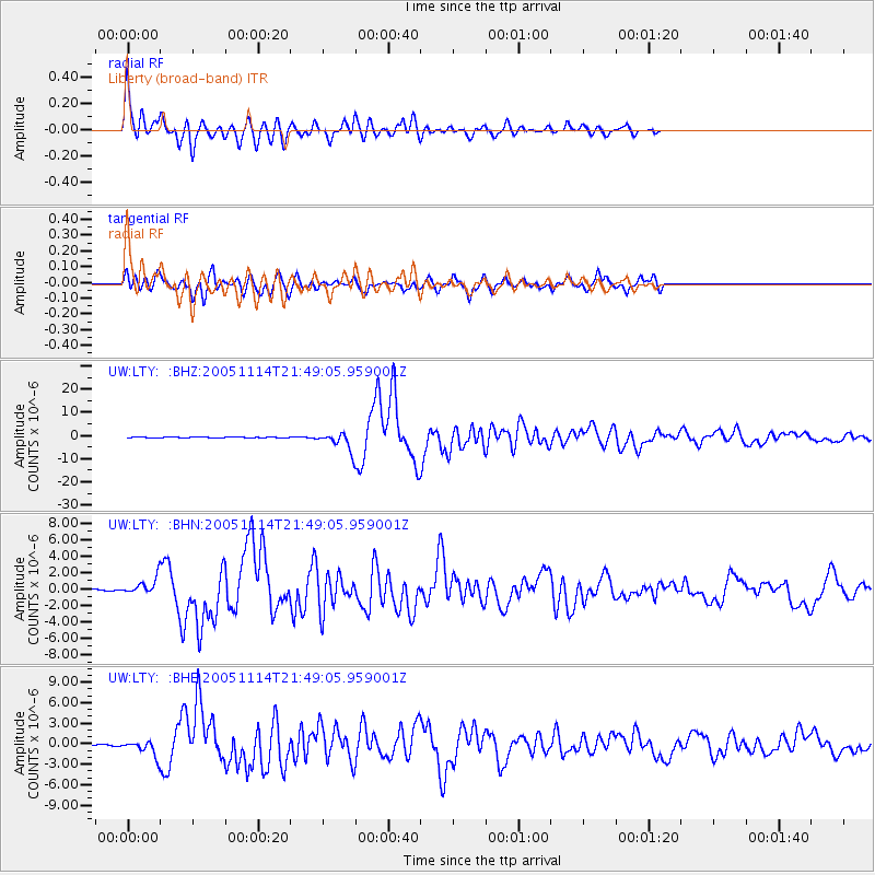
Earthquake location: Off East Coast Of Honshu, Japan
Earthquake latitude/longitude: 38.1/144.9
Earthquake time(UTC): 2005/11/14 (318) 21:38:51 GMT
Earthquake Depth: 11 km
Earthquake Magnitude: 6.7 MB, 6.8 MS, 7.0 MW, 6.9 MW
Earthquake Catalog/Contributor: WHDF/NEIC
Network: UW Pacific Northwest Regional Seismic Network
Station: LTY Liberty (broad-band)
Lat/Lon: 47.26 N/120.66 W
Elevation: 970 m
Distance: 65.9 deg
Az: 48.073 deg
Baz: 300.503 deg
Ray Param: 0.05796671
Estimated Moho Depth: 48.0 km
Estimated Crust Vp/Vs: 1.70
Assumed Crust Vp: 6.597 km/s
Estimated Crust Vs: 3.875 km/s
Estimated Crust Poisson's Ratio: 0.24
Radial Match: 90.1027 %
Radial Bump: 400
Transverse Match: 87.0542 %
Transverse Bump: 400
SOD ConfigId: 2422
Insert Time: 2010-02-27 04:48:41.560 +0000
GWidth: 2.5
Max Bumps: 400
Tol: 0.001

Signal To Noise

ChannelStoNSTALTA
UW:LTY: :BHN:20051114T21:49:05.959001Z7.66584739.369156E-71.2221945E-7
UW:LTY: :BHE:20051114T21:49:05.959001Z7.0721731.0812213E-61.5288389E-7
UW:LTY: :BHZ:20051114T21:49:05.959001Z31.4917723.7359046E-61.1863113E-7
Arrivals
Ps5.3 SECOND
PpPs19 SECOND
PsPs/PpSs24 SECOND