You are here: Home > Network List > TA - USArray Transportable Network (new EarthScope stations) Stations List
> Station V48A Smith Brothers Farm, Spring Hill, TN, USA > Earthquake Result Viewer
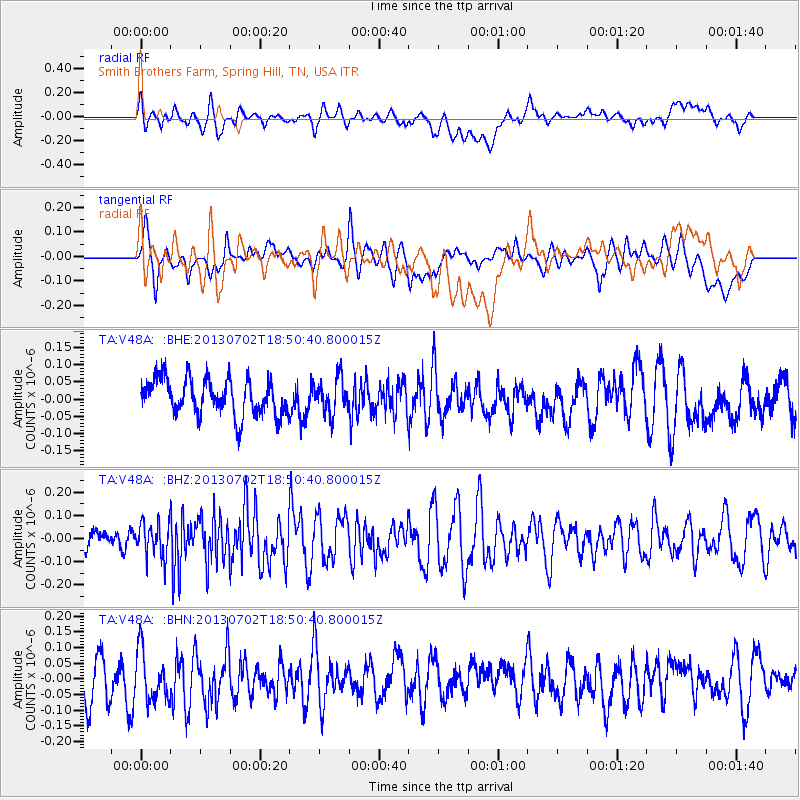
V48A Smith Brothers Farm, Spring Hill, TN, USA - Earthquake Result Viewer
*The percent match for this event was below the threshold and hence no stack was calculated.
| Earthquake location: |
Southeast Of Easter Island |
| Earthquake latitude/longitude: |
-35.9/-103.0 |
| Earthquake time(UTC): |
2013/07/02 (183) 18:39:43 GMT |
| Earthquake Depth: |
10 km |
| Earthquake Magnitude: |
5.7 MW, 5.5 MW |
| Earthquake Catalog/Contributor: |
NEIC PDE/NEIC PDE-W |
|
| Network: |
TA USArray Transportable Network (new EarthScope stations) |
| Station: |
V48A Smith Brothers Farm, Spring Hill, TN, USA |
| Lat/Lon: |
35.74 N/86.82 W |
| Elevation: |
278 m |
|
| Distance: |
72.9 deg |
| Az: |
13.691 deg |
| Baz: |
193.658 deg |
| Ray Param: |
$rayparam |
*The percent match for this event was below the threshold and hence was not used in the summary stack. |
|
| Radial Match: |
46.853737 % |
| Radial Bump: |
400 |
| Transverse Match: |
44.58185 % |
| Transverse Bump: |
400 |
| SOD ConfigId: |
512894 |
| Insert Time: |
2013-09-15 12:13:21.006 +0000 |
| GWidth: |
2.5 |
| Max Bumps: |
400 |
| Tol: |
0.001 |
|
Signal To Noise
| Channel | StoN | STA | LTA |
| TA:V48A: :BHZ:20130702T18:50:40.800015Z | 1.103909 | 7.468383E-8 | 6.765397E-8 |
| TA:V48A: :BHN:20130702T18:50:40.800015Z | 1.2422949 | 8.3769535E-8 | 6.743128E-8 |
| TA:V48A: :BHE:20130702T18:50:40.800015Z | 0.9695133 | 5.1069797E-8 | 5.267571E-8 |
| Arrivals |
| Ps | |
| PpPs | |
| PsPs/PpSs | |


