You are here: Home > Network List > TA - USArray Transportable Network (new EarthScope stations) Stations List
> Station W56A Indian Trail, NC, USA > Earthquake Result Viewer
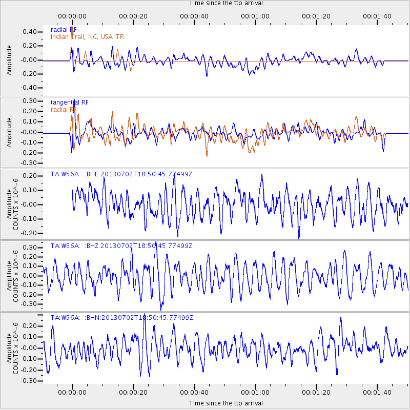
W56A Indian Trail, NC, USA - Earthquake Result Viewer
*The percent match for this event was below the threshold and hence no stack was calculated.
| Earthquake location: |
Southeast Of Easter Island |
| Earthquake latitude/longitude: |
-35.9/-103.0 |
| Earthquake time(UTC): |
2013/07/02 (183) 18:39:43 GMT |
| Earthquake Depth: |
10 km |
| Earthquake Magnitude: |
5.7 MW, 5.5 MW |
| Earthquake Catalog/Contributor: |
NEIC PDE/NEIC PDE-W |
|
| Network: |
TA USArray Transportable Network (new EarthScope stations) |
| Station: |
W56A Indian Trail, NC, USA |
| Lat/Lon: |
35.13 N/80.58 W |
| Elevation: |
177 m |
|
| Distance: |
73.7 deg |
| Az: |
18.973 deg |
| Baz: |
198.782 deg |
| Ray Param: |
$rayparam |
*The percent match for this event was below the threshold and hence was not used in the summary stack. |
|
| Radial Match: |
40.100307 % |
| Radial Bump: |
400 |
| Transverse Match: |
59.07219 % |
| Transverse Bump: |
400 |
| SOD ConfigId: |
512894 |
| Insert Time: |
2013-09-15 12:14:11.380 +0000 |
| GWidth: |
2.5 |
| Max Bumps: |
400 |
| Tol: |
0.001 |
|
Signal To Noise
| Channel | StoN | STA | LTA |
| TA:W56A: :BHZ:20130702T18:50:45.77499Z | 0.781791 | 9.3104624E-8 | 1.1909145E-7 |
| TA:W56A: :BHN:20130702T18:50:45.77499Z | 0.8321863 | 9.060464E-8 | 1.08875426E-7 |
| TA:W56A: :BHE:20130702T18:50:45.77499Z | 1.7545439 | 1.2667887E-7 | 7.2200464E-8 |
| Arrivals |
| Ps | |
| PpPs | |
| PsPs/PpSs | |


