You are here: Home > Network List > US - United States National Seismic Network Stations List
> Station AMTX Amarillo, Texas, USA > Earthquake Result Viewer
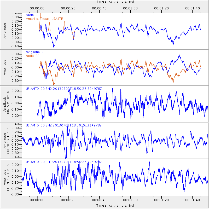
AMTX Amarillo, Texas, USA - Earthquake Result Viewer
*The percent match for this event was below the threshold and hence no stack was calculated.
| Earthquake location: |
Southeast Of Easter Island |
| Earthquake latitude/longitude: |
-35.9/-103.0 |
| Earthquake time(UTC): |
2013/07/02 (183) 18:39:43 GMT |
| Earthquake Depth: |
10 km |
| Earthquake Magnitude: |
5.7 MW, 5.5 MW |
| Earthquake Catalog/Contributor: |
NEIC PDE/NEIC PDE-W |
|
| Network: |
US United States National Seismic Network |
| Station: |
AMTX Amarillo, Texas, USA |
| Lat/Lon: |
34.53 N/101.41 W |
| Elevation: |
1010 m |
|
| Distance: |
70.1 deg |
| Az: |
1.366 deg |
| Baz: |
181.343 deg |
| Ray Param: |
$rayparam |
*The percent match for this event was below the threshold and hence was not used in the summary stack. |
|
| Radial Match: |
26.040504 % |
| Radial Bump: |
400 |
| Transverse Match: |
29.663279 % |
| Transverse Bump: |
400 |
| SOD ConfigId: |
512894 |
| Insert Time: |
2013-09-15 12:15:55.144 +0000 |
| GWidth: |
2.5 |
| Max Bumps: |
400 |
| Tol: |
0.001 |
|
Signal To Noise
| Channel | StoN | STA | LTA |
| US:AMTX:00:BHZ:20130702T18:50:26.324978Z | 0.94845074 | 6.804068E-8 | 7.173876E-8 |
| US:AMTX:00:BH1:20130702T18:50:26.324978Z | 2.6530392 | 3.1756548E-7 | 1.1969874E-7 |
| US:AMTX:00:BH2:20130702T18:50:26.324978Z | 1.0965246 | 1.16957516E-7 | 1.06662014E-7 |
| Arrivals |
| Ps | |
| PpPs | |
| PsPs/PpSs | |


