You are here: Home > Network List > II - Global Seismograph Network (GSN - IRIS/IDA) Stations List
> Station WRAB Tennant Creek, NT, Australia > Earthquake Result Viewer
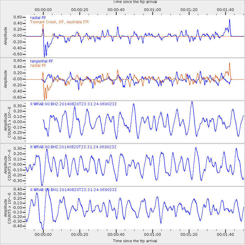
WRAB Tennant Creek, NT, Australia - Earthquake Result Viewer
*The percent match for this event was below the threshold and hence no stack was calculated.
| Earthquake location: |
East Of South Sandwich Islands |
| Earthquake latitude/longitude: |
-59.1/-17.1 |
| Earthquake time(UTC): |
2014/08/20 (232) 23:18:20 GMT |
| Earthquake Depth: |
10 km |
| Earthquake Magnitude: |
5.6 Mwc, 4.9 mb, 5.0 Ms_20, 5.5 Mwb |
| Earthquake Catalog/Contributor: |
ISC/ISC |
|
| Network: |
II Global Seismograph Network (GSN - IRIS/IDA) |
| Station: |
WRAB Tennant Creek, NT, Australia |
| Lat/Lon: |
19.93 S/134.36 E |
| Elevation: |
366 m |
|
| Distance: |
97.8 deg |
| Az: |
153.032 deg |
| Baz: |
194.401 deg |
| Ray Param: |
$rayparam |
*The percent match for this event was below the threshold and hence was not used in the summary stack. |
|
| Radial Match: |
66.84067 % |
| Radial Bump: |
400 |
| Transverse Match: |
65.71021 % |
| Transverse Bump: |
400 |
| SOD ConfigId: |
3390531 |
| Insert Time: |
2019-04-13 12:36:43.283 +0000 |
| GWidth: |
2.5 |
| Max Bumps: |
400 |
| Tol: |
0.001 |
|
Signal To Noise
| Channel | StoN | STA | LTA |
| II:WRAB:00:BHZ:20140820T23:31:24.069023Z | 2.0609632 | 2.109445E-7 | 1.0235239E-7 |
| II:WRAB:00:BH1:20140820T23:31:24.069023Z | 2.0353324 | 3.142496E-7 | 1.5439718E-7 |
| II:WRAB:00:BH2:20140820T23:31:24.069023Z | 0.7756024 | 1.1530349E-7 | 1.4866315E-7 |
| Arrivals |
| Ps | |
| PpPs | |
| PsPs/PpSs | |


