You are here: Home > Network List > US - United States National Seismic Network Stations List
> Station NEW Newport, Washington, USA > Earthquake Result Viewer
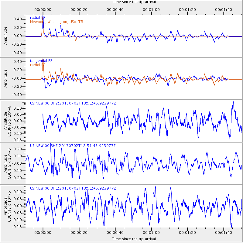
NEW Newport, Washington, USA - Earthquake Result Viewer
*The percent match for this event was below the threshold and hence no stack was calculated.
| Earthquake location: |
Southeast Of Easter Island |
| Earthquake latitude/longitude: |
-35.9/-103.0 |
| Earthquake time(UTC): |
2013/07/02 (183) 18:39:43 GMT |
| Earthquake Depth: |
10 km |
| Earthquake Magnitude: |
5.7 MW, 5.5 MW |
| Earthquake Catalog/Contributor: |
NEIC PDE/NEIC PDE-W |
|
| Network: |
US United States National Seismic Network |
| Station: |
NEW Newport, Washington, USA |
| Lat/Lon: |
48.26 N/117.12 W |
| Elevation: |
760 m |
|
| Distance: |
84.8 deg |
| Az: |
350.555 deg |
| Baz: |
168.502 deg |
| Ray Param: |
$rayparam |
*The percent match for this event was below the threshold and hence was not used in the summary stack. |
|
| Radial Match: |
57.64785 % |
| Radial Bump: |
400 |
| Transverse Match: |
53.600327 % |
| Transverse Bump: |
400 |
| SOD ConfigId: |
512894 |
| Insert Time: |
2013-09-15 12:17:01.769 +0000 |
| GWidth: |
2.5 |
| Max Bumps: |
400 |
| Tol: |
0.001 |
|
Signal To Noise
| Channel | StoN | STA | LTA |
| US:NEW:00:BHZ:20130702T18:51:45.923977Z | 1.8799411 | 1.005447E-7 | 5.3482903E-8 |
| US:NEW:00:BH1:20130702T18:51:45.923977Z | 1.143851 | 4.0919847E-8 | 3.5773756E-8 |
| US:NEW:00:BH2:20130702T18:51:45.923977Z | 0.66692173 | 2.553247E-8 | 3.828406E-8 |
| Arrivals |
| Ps | |
| PpPs | |
| PsPs/PpSs | |


