LTY Liberty (broad-band) - Earthquake Result Viewer
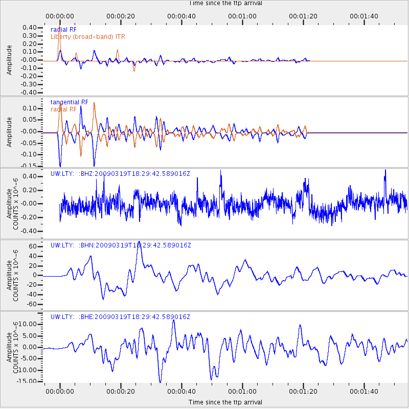
Earthquake location: Tonga Islands Region
Earthquake latitude/longitude: -23.0/-174.7
Earthquake time(UTC): 2009/03/19 (078) 18:17:40 GMT
Earthquake Depth: 34 km
Earthquake Magnitude: 7.0 MB, 7.6 MS, 7.6 MW, 7.6 MW
Earthquake Catalog/Contributor: WHDF/NEIC
Network: UW Pacific Northwest Regional Seismic Network
Station: LTY Liberty (broad-band)
Lat/Lon: 47.26 N/120.66 W
Elevation: 970 m
Distance: 85.2 deg
Az: 33.573 deg
Baz: 228.4 deg
Ray Param: 0.044898637
Estimated Moho Depth: 24.75 km
Estimated Crust Vp/Vs: 2.10
Assumed Crust Vp: 6.597 km/s
Estimated Crust Vs: 3.145 km/s
Estimated Crust Poisson's Ratio: 0.35
Radial Match: 94.58396 %
Radial Bump: 400
Transverse Match: 94.786316 %
Transverse Bump: 400
SOD ConfigId: 2658
Insert Time: 2010-02-27 04:48:59.243 +0000
GWidth: 2.5
Max Bumps: 400
Tol: 0.001

Signal To Noise

ChannelStoNSTALTA
UW:LTY: :BHN:20090319T18:29:42.589016Z26.19727.1222285E-62.7186982E-7
UW:LTY: :BHE:20090319T18:29:42.589016Z8.091931.2549798E-61.5509028E-7
UW:LTY: :BHZ:20090319T18:29:42.589016Z0.73532987.78578E-81.0588146E-7
Arrivals
Ps4.2 SECOND
PpPs11 SECOND
PsPs/PpSs16 SECOND