You are here: Home > Network List > TA - USArray Transportable Network (new EarthScope stations) Stations List
> Station G03D McMinnville, OR, USA > Earthquake Result Viewer
G03D McMinnville, OR, USA - Earthquake Result Viewer
*The percent match for this event was below the threshold and hence no stack was calculated.
| Earthquake location: |
Jujuy Province, Argentina |
| Earthquake latitude/longitude: |
-23.9/-66.5 |
| Earthquake time(UTC): |
2013/07/02 (183) 20:04:55 GMT |
| Earthquake Depth: |
199 km |
| Earthquake Magnitude: |
5.6 MW, 5.7 MW |
| Earthquake Catalog/Contributor: |
NEIC PDE/NEIC PDE-W |
|
| Network: |
TA USArray Transportable Network (new EarthScope stations) |
| Station: |
G03D McMinnville, OR, USA |
| Lat/Lon: |
45.21 N/123.26 W |
| Elevation: |
222 m |
|
| Distance: |
86.0 deg |
| Az: |
323.658 deg |
| Baz: |
129.862 deg |
| Ray Param: |
$rayparam |
*The percent match for this event was below the threshold and hence was not used in the summary stack. |
|
| Radial Match: |
55.57741 % |
| Radial Bump: |
400 |
| Transverse Match: |
55.640533 % |
| Transverse Bump: |
400 |
| SOD ConfigId: |
512894 |
| Insert Time: |
2013-09-15 12:44:44.860 +0000 |
| GWidth: |
2.5 |
| Max Bumps: |
400 |
| Tol: |
0.001 |
|
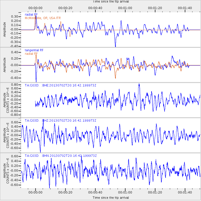
Signal To Noise
| Channel | StoN | STA | LTA |
| TA:G03D: :BHZ:20130702T20:16:42.199973Z | 1.2789354 | 2.892577E-7 | 2.2617068E-7 |
| TA:G03D: :BHN:20130702T20:16:42.199973Z | 1.0494554 | 2.2836184E-7 | 2.1760032E-7 |
| TA:G03D: :BHE:20130702T20:16:42.199973Z | 1.2224438 | 2.1796986E-7 | 1.7830665E-7 |
| Arrivals |
| Ps | |
| PpPs | |
| PsPs/PpSs | |


