You are here: Home > Network List > TA - USArray Transportable Network (new EarthScope stations) Stations List
> Station G05D Wamic, OR, USA > Earthquake Result Viewer
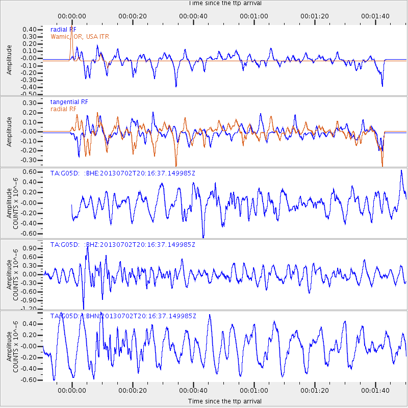
G05D Wamic, OR, USA - Earthquake Result Viewer
*The percent match for this event was below the threshold and hence no stack was calculated.
| Earthquake location: |
Jujuy Province, Argentina |
| Earthquake latitude/longitude: |
-23.9/-66.5 |
| Earthquake time(UTC): |
2013/07/02 (183) 20:04:55 GMT |
| Earthquake Depth: |
199 km |
| Earthquake Magnitude: |
5.6 MW, 5.7 MW |
| Earthquake Catalog/Contributor: |
NEIC PDE/NEIC PDE-W |
|
| Network: |
TA USArray Transportable Network (new EarthScope stations) |
| Station: |
G05D Wamic, OR, USA |
| Lat/Lon: |
45.24 N/121.32 W |
| Elevation: |
592 m |
|
| Distance: |
84.9 deg |
| Az: |
324.579 deg |
| Baz: |
131.313 deg |
| Ray Param: |
$rayparam |
*The percent match for this event was below the threshold and hence was not used in the summary stack. |
|
| Radial Match: |
40.781868 % |
| Radial Bump: |
377 |
| Transverse Match: |
28.740625 % |
| Transverse Bump: |
344 |
| SOD ConfigId: |
512894 |
| Insert Time: |
2013-09-15 12:44:50.537 +0000 |
| GWidth: |
2.5 |
| Max Bumps: |
400 |
| Tol: |
0.001 |
|
Signal To Noise
| Channel | StoN | STA | LTA |
| TA:G05D: :BHZ:20130702T20:16:37.149985Z | 2.4993434 | 4.066366E-7 | 1.6269738E-7 |
| TA:G05D: :BHN:20130702T20:16:37.149985Z | 2.004169 | 4.0164653E-7 | 2.0040552E-7 |
| TA:G05D: :BHE:20130702T20:16:37.149985Z | 1.4329406 | 2.2480063E-7 | 1.5688063E-7 |
| Arrivals |
| Ps | |
| PpPs | |
| PsPs/PpSs | |


