You are here: Home > Network List > TA - USArray Transportable Network (new EarthScope stations) Stations List
> Station M54A Oil Creek State Park, Oil City, PA, USA > Earthquake Result Viewer
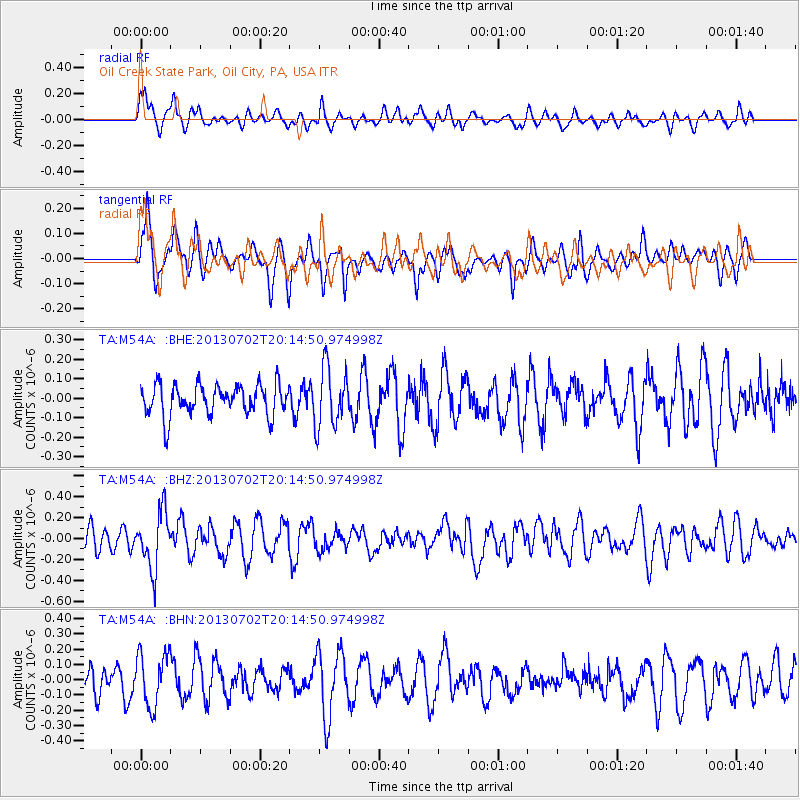
M54A Oil Creek State Park, Oil City, PA, USA - Earthquake Result Viewer
*The percent match for this event was below the threshold and hence no stack was calculated.
| Earthquake location: |
Jujuy Province, Argentina |
| Earthquake latitude/longitude: |
-23.9/-66.5 |
| Earthquake time(UTC): |
2013/07/02 (183) 20:04:55 GMT |
| Earthquake Depth: |
199 km |
| Earthquake Magnitude: |
5.6 MW, 5.7 MW |
| Earthquake Catalog/Contributor: |
NEIC PDE/NEIC PDE-W |
|
| Network: |
TA USArray Transportable Network (new EarthScope stations) |
| Station: |
M54A Oil Creek State Park, Oil City, PA, USA |
| Lat/Lon: |
41.51 N/79.66 W |
| Elevation: |
488 m |
|
| Distance: |
66.2 deg |
| Az: |
349.235 deg |
| Baz: |
166.838 deg |
| Ray Param: |
$rayparam |
*The percent match for this event was below the threshold and hence was not used in the summary stack. |
|
| Radial Match: |
52.152275 % |
| Radial Bump: |
400 |
| Transverse Match: |
54.096092 % |
| Transverse Bump: |
384 |
| SOD ConfigId: |
512894 |
| Insert Time: |
2013-09-15 12:48:07.481 +0000 |
| GWidth: |
2.5 |
| Max Bumps: |
400 |
| Tol: |
0.001 |
|
Signal To Noise
| Channel | StoN | STA | LTA |
| TA:M54A: :BHZ:20130702T20:14:50.974998Z | 3.3074234 | 2.744274E-7 | 8.2973166E-8 |
| TA:M54A: :BHN:20130702T20:14:50.974998Z | 2.2444792 | 1.7159779E-7 | 7.6453276E-8 |
| TA:M54A: :BHE:20130702T20:14:50.974998Z | 1.9437686 | 1.5351912E-7 | 7.8980136E-8 |
| Arrivals |
| Ps | |
| PpPs | |
| PsPs/PpSs | |


