You are here: Home > Network List > TA - USArray Transportable Network (new EarthScope stations) Stations List
> Station O48A Farmland, IN, USA > Earthquake Result Viewer
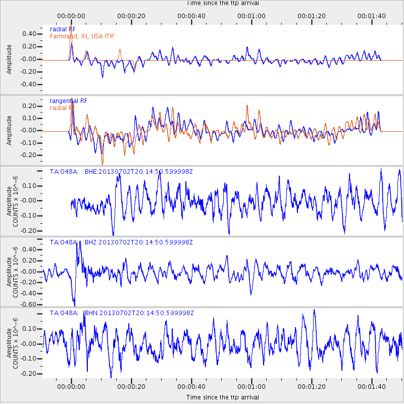
O48A Farmland, IN, USA - Earthquake Result Viewer
*The percent match for this event was below the threshold and hence no stack was calculated.
| Earthquake location: |
Jujuy Province, Argentina |
| Earthquake latitude/longitude: |
-23.9/-66.5 |
| Earthquake time(UTC): |
2013/07/02 (183) 20:04:55 GMT |
| Earthquake Depth: |
199 km |
| Earthquake Magnitude: |
5.6 MW, 5.7 MW |
| Earthquake Catalog/Contributor: |
NEIC PDE/NEIC PDE-W |
|
| Network: |
TA USArray Transportable Network (new EarthScope stations) |
| Station: |
O48A Farmland, IN, USA |
| Lat/Lon: |
40.26 N/85.16 W |
| Elevation: |
300 m |
|
| Distance: |
66.1 deg |
| Az: |
344.483 deg |
| Baz: |
161.332 deg |
| Ray Param: |
$rayparam |
*The percent match for this event was below the threshold and hence was not used in the summary stack. |
|
| Radial Match: |
51.699543 % |
| Radial Bump: |
400 |
| Transverse Match: |
51.523586 % |
| Transverse Bump: |
400 |
| SOD ConfigId: |
512894 |
| Insert Time: |
2013-09-15 12:49:27.301 +0000 |
| GWidth: |
2.5 |
| Max Bumps: |
400 |
| Tol: |
0.001 |
|
Signal To Noise
| Channel | StoN | STA | LTA |
| TA:O48A: :BHZ:20130702T20:14:50.599998Z | 4.2545714 | 3.2078486E-7 | 7.539769E-8 |
| TA:O48A: :BHN:20130702T20:14:50.599998Z | 1.4245434 | 1.1217245E-7 | 7.8742744E-8 |
| TA:O48A: :BHE:20130702T20:14:50.599998Z | 1.2034192 | 9.0865704E-8 | 7.550628E-8 |
| Arrivals |
| Ps | |
| PpPs | |
| PsPs/PpSs | |


