You are here: Home > Network List > TA - USArray Transportable Network (new EarthScope stations) Stations List
> Station Q24A Divide, CO, USA > Earthquake Result Viewer
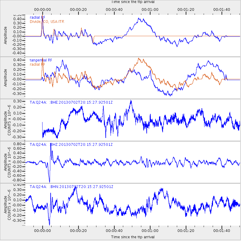
Q24A Divide, CO, USA - Earthquake Result Viewer
*The percent match for this event was below the threshold and hence no stack was calculated.
| Earthquake location: |
Jujuy Province, Argentina |
| Earthquake latitude/longitude: |
-23.9/-66.5 |
| Earthquake time(UTC): |
2013/07/02 (183) 20:04:55 GMT |
| Earthquake Depth: |
199 km |
| Earthquake Magnitude: |
5.6 MW, 5.7 MW |
| Earthquake Catalog/Contributor: |
NEIC PDE/NEIC PDE-W |
|
| Network: |
TA USArray Transportable Network (new EarthScope stations) |
| Station: |
Q24A Divide, CO, USA |
| Lat/Lon: |
38.96 N/105.15 W |
| Elevation: |
2775 m |
|
| Distance: |
72.2 deg |
| Az: |
329.255 deg |
| Baz: |
143.102 deg |
| Ray Param: |
$rayparam |
*The percent match for this event was below the threshold and hence was not used in the summary stack. |
|
| Radial Match: |
52.176575 % |
| Radial Bump: |
400 |
| Transverse Match: |
46.12227 % |
| Transverse Bump: |
400 |
| SOD ConfigId: |
512894 |
| Insert Time: |
2013-09-15 12:50:29.325 +0000 |
| GWidth: |
2.5 |
| Max Bumps: |
400 |
| Tol: |
0.001 |
|
Signal To Noise
| Channel | StoN | STA | LTA |
| TA:Q24A: :BHZ:20130702T20:15:27.92501Z | 10.602114 | 3.517109E-7 | 3.3173656E-8 |
| TA:Q24A: :BHN:20130702T20:15:27.92501Z | 1.2923975 | 1.278901E-7 | 9.895571E-8 |
| TA:Q24A: :BHE:20130702T20:15:27.92501Z | 0.7344837 | 1.14310545E-7 | 1.5563387E-7 |
| Arrivals |
| Ps | |
| PpPs | |
| PsPs/PpSs | |


