You are here: Home > Network List > TA - USArray Transportable Network (new EarthScope stations) Stations List
> Station U46A Springville, TN, USA > Earthquake Result Viewer
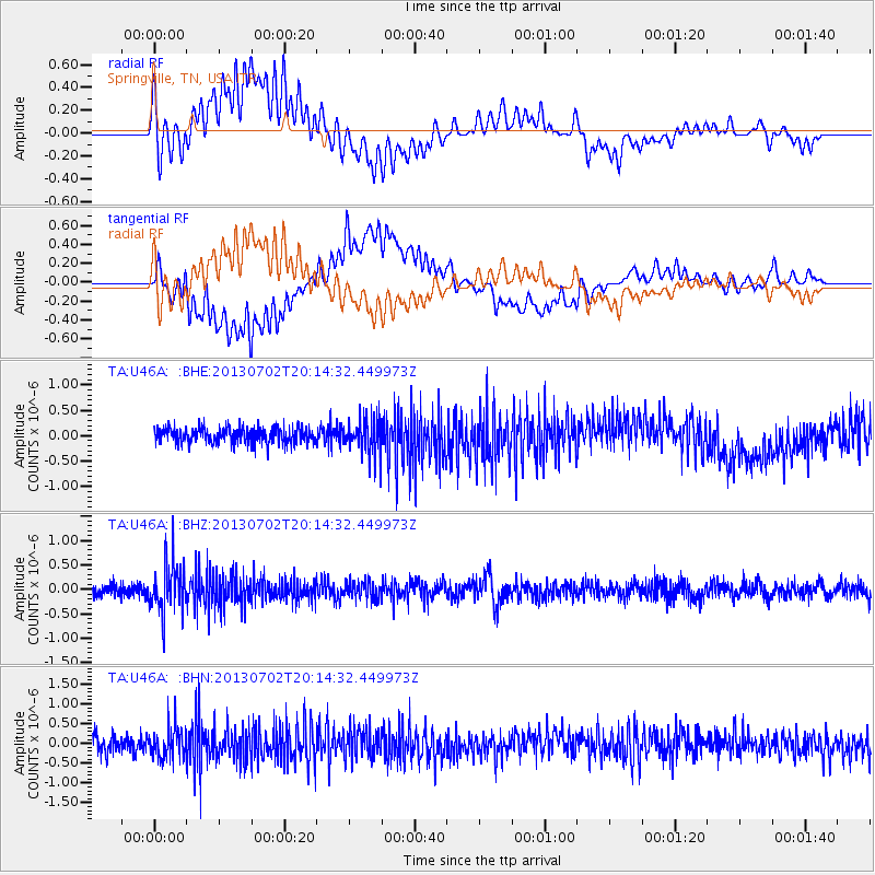
U46A Springville, TN, USA - Earthquake Result Viewer
*The percent match for this event was below the threshold and hence no stack was calculated.
| Earthquake location: |
Jujuy Province, Argentina |
| Earthquake latitude/longitude: |
-23.9/-66.5 |
| Earthquake time(UTC): |
2013/07/02 (183) 20:04:55 GMT |
| Earthquake Depth: |
199 km |
| Earthquake Magnitude: |
5.6 MW, 5.7 MW |
| Earthquake Catalog/Contributor: |
NEIC PDE/NEIC PDE-W |
|
| Network: |
TA USArray Transportable Network (new EarthScope stations) |
| Station: |
U46A Springville, TN, USA |
| Lat/Lon: |
36.36 N/88.18 W |
| Elevation: |
146 m |
|
| Distance: |
63.3 deg |
| Az: |
340.515 deg |
| Baz: |
157.768 deg |
| Ray Param: |
$rayparam |
*The percent match for this event was below the threshold and hence was not used in the summary stack. |
|
| Radial Match: |
48.81852 % |
| Radial Bump: |
400 |
| Transverse Match: |
59.063183 % |
| Transverse Bump: |
400 |
| SOD ConfigId: |
512894 |
| Insert Time: |
2013-09-15 12:53:25.211 +0000 |
| GWidth: |
2.5 |
| Max Bumps: |
400 |
| Tol: |
0.001 |
|
Signal To Noise
| Channel | StoN | STA | LTA |
| TA:U46A: :BHZ:20130702T20:14:32.449973Z | 4.539323 | 4.840375E-7 | 1.0663209E-7 |
| TA:U46A: :BHN:20130702T20:14:32.449973Z | 2.244547 | 3.9708772E-7 | 1.769122E-7 |
| TA:U46A: :BHE:20130702T20:14:32.449973Z | 2.3053176 | 3.515391E-7 | 1.5249053E-7 |
| Arrivals |
| Ps | |
| PpPs | |
| PsPs/PpSs | |


