You are here: Home > Network List > TA - USArray Transportable Network (new EarthScope stations) Stations List
> Station X43A Marvell, AR, USA > Earthquake Result Viewer
X43A Marvell, AR, USA - Earthquake Result Viewer
*The percent match for this event was below the threshold and hence no stack was calculated.
| Earthquake location: |
Jujuy Province, Argentina |
| Earthquake latitude/longitude: |
-23.9/-66.5 |
| Earthquake time(UTC): |
2013/07/02 (183) 20:04:55 GMT |
| Earthquake Depth: |
199 km |
| Earthquake Magnitude: |
5.6 MW, 5.7 MW |
| Earthquake Catalog/Contributor: |
NEIC PDE/NEIC PDE-W |
|
| Network: |
TA USArray Transportable Network (new EarthScope stations) |
| Station: |
X43A Marvell, AR, USA |
| Lat/Lon: |
34.52 N/90.88 W |
| Elevation: |
53 m |
|
| Distance: |
62.5 deg |
| Az: |
337.414 deg |
| Baz: |
154.794 deg |
| Ray Param: |
$rayparam |
*The percent match for this event was below the threshold and hence was not used in the summary stack. |
|
| Radial Match: |
53.000275 % |
| Radial Bump: |
400 |
| Transverse Match: |
58.465588 % |
| Transverse Bump: |
400 |
| SOD ConfigId: |
512894 |
| Insert Time: |
2013-09-15 12:55:43.916 +0000 |
| GWidth: |
2.5 |
| Max Bumps: |
400 |
| Tol: |
0.001 |
|
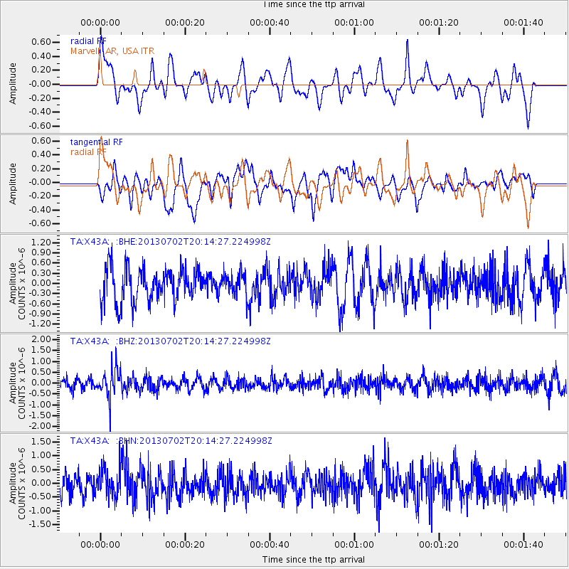
Signal To Noise
| Channel | StoN | STA | LTA |
| TA:X43A: :BHZ:20130702T20:14:27.224998Z | 2.626065 | 6.649123E-7 | 2.531972E-7 |
| TA:X43A: :BHN:20130702T20:14:27.224998Z | 1.1313652 | 5.053051E-7 | 4.4663307E-7 |
| TA:X43A: :BHE:20130702T20:14:27.224998Z | 0.6639489 | 3.2547567E-7 | 4.9021196E-7 |
| Arrivals |
| Ps | |
| PpPs | |
| PsPs/PpSs | |


